
IMAGES TAKEN NEAR TO
Larkhall Rise, LONDON, SW4 6JB
Introduction
This page details the photographs taken nearby to Larkhall Rise, SW4 6JB by members of the Geograph project.
The Geograph project started in 2005 with the aim of publishing, organising and preserving representative images for every square kilometre of Great Britain, Ireland and the Isle of Man.

There are currently over 7.5m images from over14,400 individuals and you can help contribute to the project by visiting https://www.geograph.org.uk
Image Map
Images are licensed for reuse under creativecommons.org/licenses/by-sa/2.0
Notes
- Clicking on the map will re-center to the selected point.
- The higher the marker number, the further away the image location is from the centre of the postcode.
Image Listing (119 Images Found)
Images are licensed for reuse under creativecommons.org/licenses/by-sa/2.0
Image
Details
Distance
1
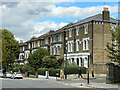
Larkhall Rise
Late 19th Century houses in Larkhall Rise. The buildings here are shown on the 1895 1:1056 map, whereas the previous 1874 edition shows what would appear to be earlier terraced housing along all this section of the road, including across where the junction with Sibella Road (the side road on the far right of the photo) now stands.
Image: © Ian Capper
Taken: 7 Oct 2022
0.03 miles
2
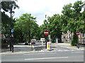
Albion Avenue, SW8
Albion Avenue is a residential road in South London. It has been made no-entry at its eastern end, to prevent traffic from using it as a short-cut in this direction. Cycles can still go through, however.
Image: © Malc McDonald
Taken: 30 May 2011
0.03 miles
3
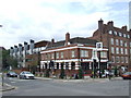
Duke of York pub, near Stockwell
The Duke of York (or "DoY") at the corner of Larkhall Lane and Union Road, near Stockwell in South London.
The pub makes in interesting contrast with the modern building to the left.
Image: © Malc McDonald
Taken: 30 May 2011
0.08 miles
4
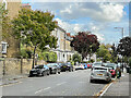
Gauden Road
Late 19th Century residential street off Larkhall Rise. The road is shown fully developed on the 1895 1:1056 map, whereas the previous 1874 edition shows a timber yard and saw mill on part of the site.
Image: © Ian Capper
Taken: 7 Oct 2022
0.09 miles
5
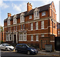
Former police station, Union Grove, Clapham
Built in 1907.
Image: © Jim Osley
Taken: 23 Oct 2016
0.10 miles
6
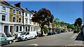
Gauden Road
Terrace housing in a Clapham street.
Image: © James Emmans
Taken: 8 May 2022
0.10 miles
7
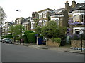
Sibella Road SW4
There are several houses in this immediate area with this distinctive design.
Image: © Danny P Robinson
Taken: 9 May 2006
0.10 miles
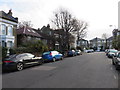
9
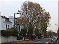
Tree and houses in Bromfelde Road, Clapham
A wide residential road close to Clapham High Street
Image: © David Smith
Taken: 28 Nov 2013
0.11 miles
10
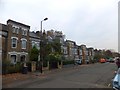
An Englishman's home is his castle, Bromfelde Road
Houses with towers overlooking the residential road
Image: © David Smith
Taken: 28 Nov 2013
0.11 miles