
IMAGES TAKEN NEAR TO
Elmhurst Street, LONDON, SW4 6HH
Introduction
This page details the photographs taken nearby to Elmhurst Street, SW4 6HH by members of the Geograph project.
The Geograph project started in 2005 with the aim of publishing, organising and preserving representative images for every square kilometre of Great Britain, Ireland and the Isle of Man.

There are currently over 7.5m images from over14,400 individuals and you can help contribute to the project by visiting https://www.geograph.org.uk
Image Map
Images are licensed for reuse under creativecommons.org/licenses/by-sa/2.0
Notes
- Clicking on the map will re-center to the selected point.
- The higher the marker number, the further away the image location is from the centre of the postcode.
Image Listing (140 Images Found)
Images are licensed for reuse under creativecommons.org/licenses/by-sa/2.0
Image
Details
Distance
1
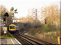
London Overground train at Voltaire Road Junction
This junction is not at a divergence of routes, rather a crossover between the two parallel pairs of tracks through Clapham High Street station. The southern pair serves the London Overground service from Highbury & Islington to Clapham Junction (as seen here), and the northern pair are the lines from Victoria to Nunhead, Lewisham and beyond (also serving freight on the West/South London route).
Image: © Stephen Craven
Taken: 13 Jan 2013
0.04 miles
2
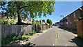
Timber Mill Way
Factory buildings line the street.
Image: © James Emmans
Taken: 8 May 2022
0.09 miles
3
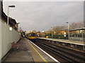
Clapham High Street Station
Looking westwards as a London Overground service departs towards Clapham Junction. The fence at the left separates the platform from the original station building, which is now a gated housing development.
Image: © Stephen Craven
Taken: 13 Jan 2013
0.12 miles
4
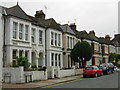
Edgeley Road, Clapham
Seen here at the junction with Voltaire Road.
Image: © Stephen McKay
Taken: 9 Oct 2009
0.12 miles
5
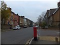
Gauden Road, Clapham
On the south side are substantial semi-detached and detached houses with decorative brickwork
Image: © David Smith
Taken: 28 Nov 2013
0.12 miles
6
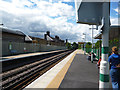
Clapham High Street station
Looking northwest (towards Victoria). The two platforms at this station serve the South London line.
Image: © Dr Neil Clifton
Taken: 11 Jul 2012
0.13 miles
7
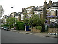
Sibella Road SW4
There are several houses in this immediate area with this distinctive design.
Image: © Danny P Robinson
Taken: 9 May 2006
0.13 miles
8
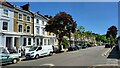
Gauden Road
Terrace housing in a Clapham street.
Image: © James Emmans
Taken: 8 May 2022
0.13 miles
9
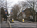
Bridge on Larkhall Rise
The bridge over the railway line (see Image) has been narrowed to a single traffic lane, which is supposed to be one-way, though a car came through the wrong way when I was about to take the photo. There is a contraflow cycle lane as Larkhall Rise is part of route 3 of the London Cycle Network.
Image: © Stephen Craven
Taken: 4 Feb 2010
0.13 miles
10
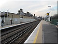
Clapham High Street railway station
Opened in 1862 by the London Chatham and Dover Railway, this side of the station was later run by the London Brighton and South Coast Railway while the LC&DR used two more platforms to the extreme right between 1867 and 1916. View north west towards London Victoria and Clapham Junction, from a similar position to Image
Image: © Nigel Thompson
Taken: 19 Mar 2013
0.14 miles