
IMAGES TAKEN NEAR TO
Offerton Road, LONDON, SW4 0DJ
Introduction
This page details the photographs taken nearby to Offerton Road, SW4 0DJ by members of the Geograph project.
The Geograph project started in 2005 with the aim of publishing, organising and preserving representative images for every square kilometre of Great Britain, Ireland and the Isle of Man.

There are currently over 7.5m images from over14,400 individuals and you can help contribute to the project by visiting https://www.geograph.org.uk
Image Map
Images are licensed for reuse under creativecommons.org/licenses/by-sa/2.0
Notes
- Clicking on the map will re-center to the selected point.
- The higher the marker number, the further away the image location is from the centre of the postcode.
Image Listing (158 Images Found)
Images are licensed for reuse under creativecommons.org/licenses/by-sa/2.0
Image
Details
Distance
1
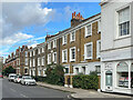
Rectory Grove
18th or 19th Century housing in Rectory Grove.
Image: © Ian Capper
Taken: 7 Oct 2022
0.09 miles
2
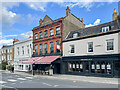
The Pig's Head and 1 & 3 Old Town
The Pig's Head, on the left, is a 19th Century pub which has gone through various names over the years: originally the Bull's Head, then the Friesian & Firkin, then the Calf, then the Rectory, before being given its current name in November 2021.
1 & 3 Old Town, on the right, was built around 1700 and is grade II listed - see https://historicengland.org.uk/listing/the-list/list-entry/1064998?section=official-list-entry.
Image: © Ian Capper
Taken: 7 Oct 2022
0.09 miles
3
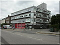
Clapham Fire Station
On Old Town, at the junction with Grafton Square; built 1964.
Image: © Mike Faherty
Taken: 16 Aug 2009
0.09 miles
4
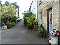
Rectory Gardens, Clapham Common Old Town
Rectory Gardens, which runs via a right angle between Rectory Grove and Fitzwilliam Road, is a very strange little street. It almost seems to be in a time warp and has always retained an arty, Bohemian feel. This is the view towards Fitzwilliam Road.
Image: © Marathon
Taken: 12 Oct 2011
0.11 miles
5
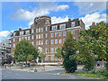
Maritime House
Building in Old Town designed by P G Bentham as the headquarters for the National Union of Seamen, built in 1939.
Image: © Ian Capper
Taken: 7 Oct 2022
0.12 miles
6
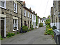
Rectory Gardens, SW4
Looking down the long leg of the L-shaped street. It is not a through route for cars, with bollards round the corner at the far end.
Image: © Robin Webster
Taken: 6 May 2012
0.12 miles
7
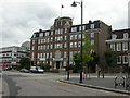
Clapham, Maritime House
On Old Town, opposite Image; built 1939 as headquarters of the National Union of Seamen, now owned by its successor, RMT Union. Used as flats for union members, solicitors' offices & a job centre.
Image: © Mike Faherty
Taken: 16 Aug 2009
0.12 miles
8
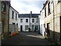
Rectory Gardens, Clapham Common Old Town
Rectory Gardens, which runs via a right angle between Rectory Grove and Fitzwilliam Road, is a very strange little street. It almost seems to be in a time warp and has always retained an arty, Bohemian feel. This is the view from Rectory Grove.
Image: © Marathon
Taken: 12 Oct 2011
0.12 miles
9
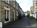
Rectory Gardens, Clapham Common Old Town
Rectory Gardens, which runs via a right angle between Rectory Grove and Fitzwilliam Road, is a very strange little street. It almost seems to be in a time warp and has always retained an arty, Bohemian feel. This is the view from Fitzwilliam Road.
Image: © Marathon
Taken: 12 Oct 2011
0.12 miles
10
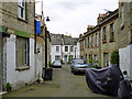
Rectory Gardens, SW4
Looking down the short leg of the L-shaped street. It is not a through route for cars, with bollards at the near end. It would be interesting to see how the cars get out - reverse all the way, or do a multi-point turn if they fit across?
Image: © Robin Webster
Taken: 6 May 2012
0.12 miles