IMAGES TAKEN NEAR TO
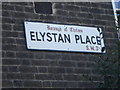
Elystan Place, LONDON, SW3 3LF
Introduction
This page details the photographs taken nearby to Elystan Place, SW3 3LF by members of the Geograph project.
The Geograph project started in 2005 with the aim of publishing, organising and preserving representative images for every square kilometre of Great Britain, Ireland and the Isle of Man.

There are currently over 7.5m images from over14,400 individuals and you can help contribute to the project by visiting https://www.geograph.org.uk
Image Map
Images are licensed for reuse under creativecommons.org/licenses/by-sa/2.0
Notes
- Clicking on the map will re-center to the selected point.
- The higher the marker number, the further away the image location is from the centre of the postcode.
Image Listing (386 Images Found)
Images are licensed for reuse under creativecommons.org/licenses/by-sa/2.0
Image
Details
Distance
6
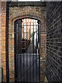
Gate to alley
Between Sprimont Place and Whitehead's Grove
Image: © PAUL FARMER
Taken: 4 Mar 2009
0.03 miles
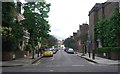
7
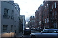
View down Bray Place
Looking south-southwest.
Image: © Robert Lamb
Taken: 30 Jan 2016
0.03 miles
8
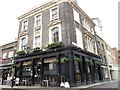
The Queen's Head, Elystan Place / Tyron Street, SW3 (2)
Image: © Mike Quinn
Taken: 29 May 2013
0.03 miles
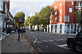
10
Queen's Head, Chelsea
There isn't a high density of pubs locally.
Image: © Bill Boaden
Taken: 10 Oct 2014
0.03 miles