IMAGES TAKEN NEAR TO
Whiteheads Grove, LONDON, SW3 3HB
Introduction
This page details the photographs taken nearby to Whiteheads Grove, SW3 3HB by members of the Geograph project.
The Geograph project started in 2005 with the aim of publishing, organising and preserving representative images for every square kilometre of Great Britain, Ireland and the Isle of Man.

There are currently over 7.5m images from over14,400 individuals and you can help contribute to the project by visiting https://www.geograph.org.uk
Image Map
Images are licensed for reuse under creativecommons.org/licenses/by-sa/2.0
Notes
- Clicking on the map will re-center to the selected point.
- The higher the marker number, the further away the image location is from the centre of the postcode.
Image Listing (433 Images Found)
Images are licensed for reuse under creativecommons.org/licenses/by-sa/2.0
Image
Details
Distance
1
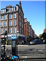
Elystan Street SW3
At the junction with Cale Street - taken from the junction with Markham Street
Image: © Robin Sones
Taken: 10 Oct 2010
0.00 miles
3
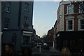
View up Elystan Street from Markham Street
Looking north-northwest.
Image: © Robert Lamb
Taken: 30 Jan 2016
0.02 miles
6
View up Whitehead's Grove from Cale Street
Looking north-northeast.
Image: © Robert Lamb
Taken: 30 Jan 2016
0.03 miles
7
Geales Restaurant, Cale Street SW3
At the junction with Markham Street
Image: © Robin Sones
Taken: 10 Oct 2010
0.03 miles
9
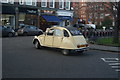
View of a Citroen 2CV driving into Whitehead's Grove
Looking north-northeast.
Image: © Robert Lamb
Taken: 30 Jan 2016
0.03 miles
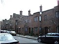
10
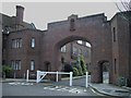
The Gateways
The Gateways is a private road from Whitehead's Grove to Sprimont Place
Image: © PAUL FARMER
Taken: 4 Mar 2009
0.03 miles