IMAGES TAKEN NEAR TO
Richards Place, LONDON, SW3 2LA
Introduction
This page details the photographs taken nearby to Richards Place, SW3 2LA by members of the Geograph project.
The Geograph project started in 2005 with the aim of publishing, organising and preserving representative images for every square kilometre of Great Britain, Ireland and the Isle of Man.

There are currently over 7.5m images from over14,400 individuals and you can help contribute to the project by visiting https://www.geograph.org.uk
Image Map
Images are licensed for reuse under creativecommons.org/licenses/by-sa/2.0
Notes
- Clicking on the map will re-center to the selected point.
- The higher the marker number, the further away the image location is from the centre of the postcode.
Image Listing (369 Images Found)
Images are licensed for reuse under creativecommons.org/licenses/by-sa/2.0
Image
Details
Distance
4
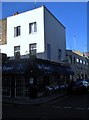
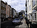
Le Suquet, Draycott Place SW3
At the junction of Donne Place
Image: © Robin Sones
Taken: 10 Oct 2010
0.07 miles
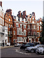
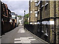
7
Walton Street SW3
At the junction with Draycott Avenue
Image: © Robin Sones
Taken: 10 Oct 2010
0.09 miles
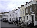
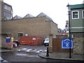
8
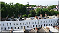
Walton Street, London SW3
View north across the roof tops of Walton Street, past the rear of Egerton Crescent towards the dome of the Brompton Oratory in the background of the frame.
Image: © Paul Leonard
Taken: 19 Jun 2007
0.09 miles
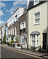
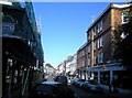
9
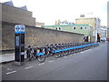
London cycle hire docking station, Denyer Street, Chelsea
Image: © PAUL FARMER
Taken: 17 Aug 2010
0.09 miles