
IMAGES TAKEN NEAR TO
Daysbrook Road, LONDON, SW2 3TD
Introduction
This page details the photographs taken nearby to Daysbrook Road, SW2 3TD by members of the Geograph project.
The Geograph project started in 2005 with the aim of publishing, organising and preserving representative images for every square kilometre of Great Britain, Ireland and the Isle of Man.

There are currently over 7.5m images from over14,400 individuals and you can help contribute to the project by visiting https://www.geograph.org.uk
Image Map
Images are licensed for reuse under creativecommons.org/licenses/by-sa/2.0
Notes
- Clicking on the map will re-center to the selected point.
- The higher the marker number, the further away the image location is from the centre of the postcode.
Image Listing (127 Images Found)
Images are licensed for reuse under creativecommons.org/licenses/by-sa/2.0
Image
Details
Distance
1
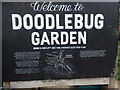
Information board at Doodlebug Garden, Streatham Hill
A photograph of the garden can be seen at www.geograph.org.uk/photo/7487365
Image: © Marathon
Taken: 4 May 2023
0.05 miles
2

Plaque at Doodlebug Garden, Streatham Hill
A photograph of the garden can be seen at www.geograph.org.uk/photo/7487365 and the information board at www.geograph.org.uk/photo/7487369
Image: © Marathon
Taken: 4 May 2023
0.05 miles
3
Doodlebug Garden, Wavertree Road
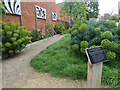
Just before midnight on 27th July 1944, a V1 landed here and killed Charles Kerby, a nearby resident living at 23 Wavertree Road. The site was neglected for many years but this garden has now been created by local residents. See photographs for close ups of the information board at the entrance www.geograph.org.uk/photo/7487369 and the plaque on the right www.geograph.org.uk/photo/7487375
Image: © Marathon
Taken: 4 May 2023
0.05 miles
4
Doodlebug Garden, Wavertree Road
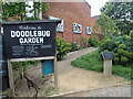
Just before midnight on 27th July 1944, a V1 landed here and killed Charles Kerby, a nearby resident living at 23 Wavertree Road. The site was neglected for many years but this garden has now been created by local residents. See photographs for close ups of the information board on the left www.geograph.org.uk/photo/7487369 and the plaque on the right www.geograph.org.uk/photo/7487375
Image: © Marathon
Taken: 4 May 2023
0.05 miles
5
Doodlebug Garden, Wavertree Road
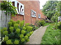
Just before midnight on 27th July 1944, a V1 landed here and killed Charles Kerby, a nearby resident living at 23 Wavertree Road. The site was neglected for many years but this garden has now been created by local residents. See a photograph at www.geograph.org.uk/photo/7487369 for a close up of the information board.
Image: © Marathon
Taken: 4 May 2023
0.05 miles
6
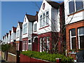
Terraced Housing
These attractive edwardian terraces are in Wyatt Park Rd which runs from Streatham Hill the A23 to Normanhurst Rd.
Image: © Nigel Mykura
Taken: 5 Mar 2013
0.05 miles
7
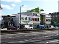
39-43 Streatham Hill
No. 39 is a small two-storey rendered house. The building on the right is a 1960s office block currently used as a healthcare centre. They are within the Streatham High Road and Streatham Hill Conservation Area for their group value.
The course of Streatham High Road has been a major highway between London and Sussex since Roman times. Its current appearance is largely attributable to two major spells of development. The first was during the late C19th following the opening of Streatham Hill station in 1856, and the second was after 1911 when the line to Victoria was electrified. Though much-maligned and undoubtedly blighted by heavy traffic, closer examination reveals that the road is lined with a number of interesting buildings, some of which reflect the period between the wars when Streatham was a fashionable centre of entertainment. Information from Lambeth Council (http://www.lambeth.gov.uk/NR/exeres/CE4B5CE1-0387-40ED-B5A9-273A5160C34A.htm ).
Image: © Stephen Richards
Taken: Unknown
0.10 miles
8
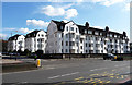
Wavertree Court, Streatham Hill
Next to Corner Fielde, more large blocks of flats, though designed in a quite different style. By Frank Harrington in 1933, with Dutch-style shaped gables, mansard roofs, metal Crittall-style windows, and white rendered walls. It is within the Streatham High Road and Streatham Hill Conservation Area.
The course of Streatham High Road has been a major highway between London and Sussex since Roman times. Its current appearance is largely attributable to two major spells of development. The first was during the late C19th following the opening of Streatham Hill station in 1856, and the second was after 1911 when the line to Victoria was electrified. Though much-maligned and undoubtedly blighted by heavy traffic, closer examination reveals that the road is lined with a number of interesting buildings, some of which reflect the period between the wars when Streatham was a fashionable centre of entertainment. Information from Lambeth Council (http://www.lambeth.gov.uk/NR/exeres/CE4B5CE1-0387-40ED-B5A9-273A5160C34A.htm ).
Image: © Stephen Richards
Taken: Unknown
0.10 miles
9
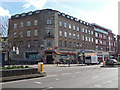
45-47 Streatham Hill
The brick corner block was built c1955 after the previous occupier of the spot was destroyed by a flying bomb on 24th June 1944. It was extended in the same style to the right, c1962. The building on the far right is a recent addition on the former site of Warwick Wright garage which preserves the scale, but is otherwise without merit.
Image: © Stephen Richards
Taken: Unknown
0.11 miles
10
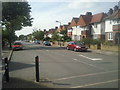
Cricklade Avenue from the corner of Faygate Road
Cricklade Avenue is part of the ABCD Estate - so called after its principal roads, Amesbury, Barcombe, Cricklade and Downton Avenues. It is more properly known as Leigham Court Estate. The original part of the ABCD Estate was built on the 66 acre estate of Leigham Court which had been purchased by the Artisans, Labourers and General Dwellings Company in 1890. Development took place in the 1890s. Suburban houses were later built further away from the main road as here in Cricklade Avenue.
Image: © Marathon
Taken: 1 Sep 2010
0.12 miles