
IMAGES TAKEN NEAR TO
Nuthurst Avenue, LONDON, SW2 3SU
Introduction
This page details the photographs taken nearby to Nuthurst Avenue, SW2 3SU by members of the Geograph project.
The Geograph project started in 2005 with the aim of publishing, organising and preserving representative images for every square kilometre of Great Britain, Ireland and the Isle of Man.

There are currently over 7.5m images from over14,400 individuals and you can help contribute to the project by visiting https://www.geograph.org.uk
Image Map
Images are licensed for reuse under creativecommons.org/licenses/by-sa/2.0
Notes
- Clicking on the map will re-center to the selected point.
- The higher the marker number, the further away the image location is from the centre of the postcode.
Image Listing (105 Images Found)
Images are licensed for reuse under creativecommons.org/licenses/by-sa/2.0
Image
Details
Distance
1
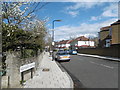
Nuthurst Avenue, Streatham Hill
This view from near the corner of Faygate Road and Downton Avenue looks down Nuthurst Avenue.
Image: © Marathon
Taken: 6 Apr 2016
0.03 miles
2
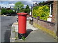
Faygate Road, Streatham Hill
This view looks along Faygate Road. Downton Avenue is the next road to be crossed. These roads are part of the ABCD Estate - so called after its principal roads, Amesbury, Barcombe, Cricklade and Downton Avenues. It is more properly known as Leigham Court Estate. The original part of the ABCD Estate was built on the 66 acre estate of Leigham Court which had been purchased by the Artisans, Labourers and General Dwellings Company in 1890. Development took place in the 1890s. Suburban houses were later built further away from the main road as here.
Apart from 'G', 'I' and 'J' the other roads on the estate follow on alphabetically. These are Emsworth Street, Faygate Road, Hailsham Avenue, Keymer Road and Lydhurst Avenue.
Image: © Marathon
Taken: 7 May 2014
0.05 miles
3
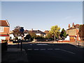
Roundabout on Faygate Road, Tulse Hill
A road from Hailsham Street, divides here.
Downton Avenue leads left to Streatham Hill and right to Hillside Road.
Normanhurst Road (upper left) heads to Wavertree Road.
Also Nuthurst Road (upper right) heads to Wavertree Road.
Image: © David Anstiss
Taken: 2 Oct 2011
0.07 miles
4
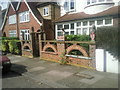
Heraldic lions in Cricklade Avenue, Streatham Hill
This ordinary suburban house had these heraldic lions added many years ago. They have mellowed with time but I am not sure of the story behind why they were put there.
Image: © Marathon
Taken: 1 Sep 2010
0.07 miles
5
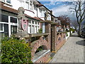
Heraldic lions in Cricklade Avenue, Streatham Hill
This ordinary suburban house had these heraldic lions added at least 50 years ago. They have mellowed with time but I am not sure of the story behind why they were put there. See also http://www.geograph.org.uk/photo/2058048
Image: © Marathon
Taken: 6 Apr 2016
0.08 miles
6
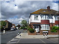
Faygate Road, Streatham Hill
This view from the corner of Cricklade Avenue looks along Faygate Road. These roads are part of the ABCD Estate - so called after its principal roads, Amesbury, Barcombe, Cricklade and Downton Avenues. It is more properly known as Leigham Court Estate. The original part of the ABCD Estate was built on the 66 acre estate of Leigham Court which had been purchased by the Artisans, Labourers and General Dwellings Company in 1890. Development took place in the 1890s. Suburban houses were later built further away from the main road as here.
Apart from 'G', 'I' and 'J' the other roads on the estate follow on alphabetically. These are Emsworth Street, Faygate Road, Hailsham Avenue, Keymer Road and Lydhurst Avenue.
Image: © Marathon
Taken: 7 May 2014
0.09 miles
7
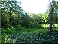
The pond in Palace Road Gardens Nature Reserve
This used to be the grounds of a large house which was demolished in the early 1980s. The grounds were fenced off and landscaped, and a small pond and circular walk were created. Many trees and shrubs present in the grounds of the original house were retained. This view is of the fenced-off pond. The original pond became choked over time and was eventually restored.
Image: © Marathon
Taken: 28 Sep 2011
0.10 miles
8
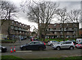
Palace Road Estate, Palace Road
Distinctively saw-toothed. Built c1973 by the Greater London Council.
Most of it actually lies on the other side of the road.
Image: © Stephen Richards
Taken: 3 Mar 2020
0.10 miles
9
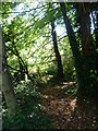
Palace Road Gardens Nature Reserve
This used to be the grounds of a large house which was demolished in the early 1980s. The grounds were fenced off and landscaped, and a small pond and circular walk were created. Many trees and shrubs present in the grounds of the original house were retained. This is within one of the areas of woodland scrub.
Image: © Marathon
Taken: 28 Sep 2011
0.10 miles
10

St Margaret, Barcombe Avenue
By Rowland Plumbe, 1889-1907. Of red brick, with a bell turret at the crossing. Grade II listed. It is within the Leigham Court Estate Conservation Area.
The Leigham Court development was one of the first model housing estates, designed for and built specifically to house the middle classes at the end of the C19th, and anticipated the garden suburbs of the early C20th. The estate was organised so that it had a sufficient mix of maisonettes, flats and houses (around 1,000 in total), as well as shops (on Streatham Hill), and a church (seen here). It was built by the Artisans', Labourers' and General Dwellings Company, whose architect was Rowland Plumbe, in 1894-1905. Although built on a grid-iron street pattern, variety was provided by the details of elevations, e.g. porches, bay windows, gables, dormers, and by the use of different materials, e.g. red, yellow and glazed bricks, clay tiles, terracotta. The estate was purchased by the London Borough of Lambeth in 1966. Information from Lambeth Council (http://www.lambeth.gov.uk/NR/exeres/CE4B5CE1-0387-40ED-B5A9-273A5160C34A.htm ).
Image: © Stephen Richards
Taken: Unknown
0.10 miles