IMAGES TAKEN NEAR TO
Gaywood Close, LONDON, SW2 3QW
Introduction
This page details the photographs taken nearby to Gaywood Close, SW2 3QW by members of the Geograph project.
The Geograph project started in 2005 with the aim of publishing, organising and preserving representative images for every square kilometre of Great Britain, Ireland and the Isle of Man.

There are currently over 7.5m images from over14,400 individuals and you can help contribute to the project by visiting https://www.geograph.org.uk
Image Map
Images are licensed for reuse under creativecommons.org/licenses/by-sa/2.0
Notes
- Clicking on the map will re-center to the selected point.
- The higher the marker number, the further away the image location is from the centre of the postcode.
Image Listing (26 Images Found)
Images are licensed for reuse under creativecommons.org/licenses/by-sa/2.0
Image
Details
Distance
1
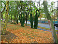
The A205 at Streatham Hill
Seen from Coburg Crescent in the Palace Road Estate.
Image: © John Allan
Taken: 9 Oct 2011
0.11 miles
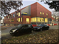
2
Flats on Roupell Road from Christchurch Road
Image: © David Howard
Taken: 27 May 2012
0.11 miles
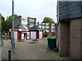
3
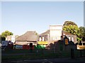
Tiny Tots Daycare Nursery, Streatham Hill
Along Palace Road.
Image: © David Anstiss
Taken: 2 Oct 2011
0.12 miles
4
Christchurch Road looking towards Roupell Road
Image: © David Howard
Taken: 27 May 2012
0.12 miles
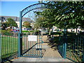
5
Fenstanton Primary School
Lane alongside Fenstanton Primary School.
Image: © Alan Hughes
Taken: 20 Jan 2018
0.12 miles
6
The site of Tulse Hill Comprehensive School
The houses beyond the playground are in Marnfield Crescent. This was originally the site of Tulse Hill Comprehensive, one of the largest schools in London, with over 2,000 boys. It opened in 1956, closed in 1990, and was demolished in the early 1990s. See https://en.wikipedia.org/wiki/Tulse_Hill_School and https://www.gettyimages.co.uk/photos/tulse-hill-school?sort=mostpopular&mediatype=photography&phrase=tulse%20hill%20school
Image: © Marathon
Taken: 28 Sep 2011
0.12 miles
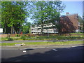
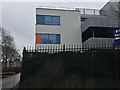
8
Development, Palace Road
Nearing completion is Lambeth Council's new resource centre for people with complex disabilities.
Image: © Stephen Richards
Taken: 23 Nov 2021
0.13 miles
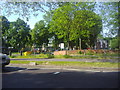
9
Palace Road Estate
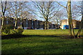
Another area of Lambeth Housing, but this is not high rise and it has a lot of green space.
Image: © Bill Boaden
Taken: 1 Feb 2014
0.14 miles
10
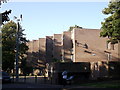
Ponton House Palace Road
Block of housing, one of eight in the estate.
Image: © David Anstiss
Taken: 2 Oct 2011
0.16 miles