
IMAGES TAKEN NEAR TO
Roupell Road, LONDON, SW2 3HA
Introduction
This page details the photographs taken nearby to Roupell Road, SW2 3HA by members of the Geograph project.
The Geograph project started in 2005 with the aim of publishing, organising and preserving representative images for every square kilometre of Great Britain, Ireland and the Isle of Man.

There are currently over 7.5m images from over14,400 individuals and you can help contribute to the project by visiting https://www.geograph.org.uk
Image Map
Images are licensed for reuse under creativecommons.org/licenses/by-sa/2.0
Notes
- Clicking on the map will re-center to the selected point.
- The higher the marker number, the further away the image location is from the centre of the postcode.
Image Listing (79 Images Found)
Images are licensed for reuse under creativecommons.org/licenses/by-sa/2.0
Image
Details
Distance
1
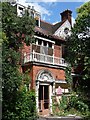
1 Palace Road
Originally known as Clinton House when it was built, probably c1884. It was the home of the writer Dennis Wheatley from 1914-30. Information from the Streatham Society (http://www.streathamsociety.org.uk/Streatham%20Society%20news%2011-09.pdf ).
Palace Road has a few surviving large late-C19th/early-C20th houses. Although this one has seen happier days, it is still attractive, possessing some typical Arts-and-Craft style flourishes - tile-hung upper storey, shell-hood porch and pargetted dormer.
Image: © Stephen Richards
Taken: 23 Jul 2009
0.03 miles
2
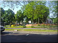
Christchurch Road looking towards Roupell Road
Image: © David Howard
Taken: 27 May 2012
0.05 miles
3
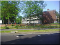
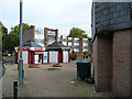
Flats on Roupell Road from Christchurch Road
Image: © David Howard
Taken: 27 May 2012
0.06 miles
6
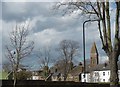
View across Daysbrook Road Covered Reservoir to the spire of Christ Church
Daysbrook Road Reservoir, like so many smaller reservoirs in inner London, is covered over. It was originally constructed in 1832 by the Lambeth Water Company. This is the view from Daysbrook Road. The houses are in Palace Road. See also http://www.geograph.org.uk/photo/2641178
For more about the architect of Christ Church see https://en.wikipedia.org/wiki/James_William_Wild
Image: © Marathon
Taken: 6 Apr 2016
0.09 miles
7
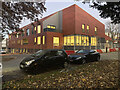
Development, Palace Road
Nearing completion is Lambeth Council's new resource centre for people with complex disabilities.
Image: © Stephen Richards
Taken: 23 Nov 2021
0.10 miles
8
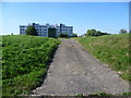
Daysbrook Road Covered Reservoir
Daysbrook Road Reservoir, like so many smaller reservoirs in inner London, is covered over. It was originally constructed in 1832 by the Lambeth Water Company. This is the view looking through the gate from Daysbrook Road. The impressive block of flats beyond is Pullman Court on Streatham Hill which was built in the second half of the 1930s.
Image: © Marathon
Taken: 28 Sep 2011
0.10 miles
9
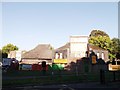
Tiny Tots Daycare Nursery, Streatham Hill
Along Palace Road.
Image: © David Anstiss
Taken: 2 Oct 2011
0.11 miles
10
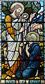
Christ Church, Christchurch Road, Streatham - Stained glass window
Image: © John Salmon
Taken: 1 Aug 2013
0.11 miles