IMAGES TAKEN NEAR TO
Abbess Close, Tulse Hill, LONDON, SW2 3BP
Introduction
This page details the photographs taken nearby to Abbess Close, Tulse Hill, SW2 3BP by members of the Geograph project.
The Geograph project started in 2005 with the aim of publishing, organising and preserving representative images for every square kilometre of Great Britain, Ireland and the Isle of Man.

There are currently over 7.5m images from over14,400 individuals and you can help contribute to the project by visiting https://www.geograph.org.uk
Image Map
Images are licensed for reuse under creativecommons.org/licenses/by-sa/2.0
Notes
- Clicking on the map will re-center to the selected point.
- The higher the marker number, the further away the image location is from the centre of the postcode.
Image Listing (90 Images Found)
Images are licensed for reuse under creativecommons.org/licenses/by-sa/2.0
Image
Details
Distance
1
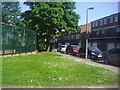
Abbess Close, Tulse Hill
This is a private estate built around the early 70s.
Image: © David Howard
Taken: 27 May 2012
0.05 miles
2
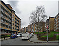
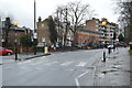
St Martin's Estate, High Trees
A big estate of ten six-storey blocks built for the London County Council from 1955.
Image: © Stephen Richards
Taken: 9 Mar 2020
0.08 miles
4
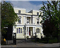
155 Tulse Hill
A stuccoed house graced by a Tuscan porch, and Corinthian columns and pilasters above. Built c1856. Grade II listed.
Since 1928 it has been occupied by St Martin-in-the-Fields High School for Girls, now a Church of England Academy.
Image: © Stephen Richards
Taken: 21 Apr 2012
0.09 miles
5
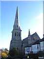
Holy Trinity Church, Tulse Hill
Anglican parish church on Trinity Rise. Built 1856 and Grade 2 listed.
Image: © Stephen Craven
Taken: 21 Nov 2006
0.11 miles
8
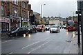
The 'Tulse Hill Hotel'
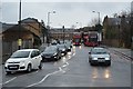
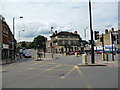
In this photograph at a busy crossroads, we are looking from Norwood Road (A215) which continues to the right in front of the red and green cars. The road coming down to form the crossroads is Tulse Hill, which is part of the South Circular Road, (A205). This road changes its name here, continuing to the right out of the picture as Thurlow Park Road. It is often said that most of the South Circular was built very easily, by drawing a pencil on a map of existing roads.
Image: © Dr Neil Clifton
Taken: 21 Jul 2012
0.13 miles