IMAGES TAKEN NEAR TO
Romanfield Road, LONDON, SW2 2UL
Introduction
This page details the photographs taken nearby to Romanfield Road, SW2 2UL by members of the Geograph project.
The Geograph project started in 2005 with the aim of publishing, organising and preserving representative images for every square kilometre of Great Britain, Ireland and the Isle of Man.

There are currently over 7.5m images from over14,400 individuals and you can help contribute to the project by visiting https://www.geograph.org.uk
Image Map (Loading...)


Getting Data...Please wait
Leaflet Map data © OpenStreetMap
Images are licensed for reuse under creativecommons.org/licenses/by-sa/2.0
Notes
- Clicking on the map will re-center to the selected point.
- The higher the marker number, the further away the image location is from the centre of the postcode.
Image Listing (41 Images Found)
Images are licensed for reuse under creativecommons.org/licenses/by-sa/2.0
Image
Details
Distance
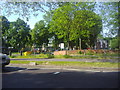
2
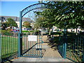
The site of Tulse Hill Comprehensive School
The houses beyond the playground are in Marnfield Crescent. This was originally the site of Tulse Hill Comprehensive, one of the largest schools in London, with over 2,000 boys. It opened in 1956, closed in 1990, and was demolished in the early 1990s. See https://en.wikipedia.org/wiki/Tulse_Hill_School and https://www.gettyimages.co.uk/photos/tulse-hill-school?sort=mostpopular&mediatype=photography&phrase=tulse%20hill%20school
Image: © Marathon
Taken: 28 Sep 2011
0.08 miles
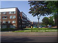
3
Brixton: Elm Court School
On Elm Park, this is now a fee-paying girls' school.
Image: © Dr Neil Clifton
Taken: 17 Jul 2012
0.13 miles
4
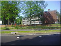
Flats on Roupell Road from Christchurch Road
Image: © David Howard
Taken: 27 May 2012
0.18 miles
5
Christchurch Road looking towards Roupell Road
Image: © David Howard
Taken: 27 May 2012
0.19 miles
7
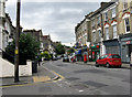
Brixton: Elm Park
Looking south from the end of Leander Road
Image: © Dr Neil Clifton
Taken: 17 Jul 2012
0.21 miles
8
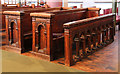
Christ Church, Christchurch Road, Streatham - Pews
Image: © John Salmon
Taken: 1 Aug 2013
0.22 miles
9
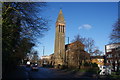
Christ Church, Streatham
This is a high church in more senses than one.
Image: © Bill Boaden
Taken: 1 Feb 2014
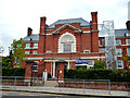
0.23 miles
10
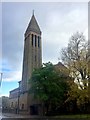
Christ Church
Christ Church, Streatham.
Image: © Alan Hughes
Taken: 4 Nov 2019
0.23 miles