IMAGES TAKEN NEAR TO
Grand Drive, LONDON, SW20 9NB
Introduction
This page details the photographs taken nearby to Grand Drive, SW20 9NB by members of the Geograph project.
The Geograph project started in 2005 with the aim of publishing, organising and preserving representative images for every square kilometre of Great Britain, Ireland and the Isle of Man.

There are currently over 7.5m images from over14,400 individuals and you can help contribute to the project by visiting https://www.geograph.org.uk
Image Map
Images are licensed for reuse under creativecommons.org/licenses/by-sa/2.0
Notes
- Clicking on the map will re-center to the selected point.
- The higher the marker number, the further away the image location is from the centre of the postcode.
Image Listing (23 Images Found)
Images are licensed for reuse under creativecommons.org/licenses/by-sa/2.0
Image
Details
Distance
2

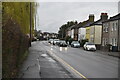
New flats by Grand Drive, Raynes Park
This road is so new it doesn't yet appear on all the online maps.
Image: © David Howard
Taken: 4 Feb 2013
0.04 miles
3
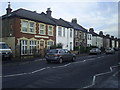
Bijou Villas , Grand Drive
This section of the upper Grand Drive was the first to be built on and at the time , 1890s, was far from other habitation. The first inhabitants lived among open farmland.
Image: © Graham Hale
Taken: 2 Dec 2012
0.04 miles
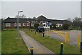
6
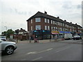
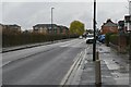
Bushey Mead: Grand Drive shops near the junction with Cannon Hill Lane
Looking east
Image: © Dr Neil Clifton
Taken: 23 Jul 2013
0.11 miles
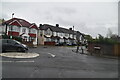
8
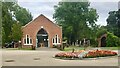
West Morden Crematorium
One of several Places of Worship at the Crematorium.
Image: © Jay Pea
Taken: 14 Sep 2021
0.11 miles