IMAGES TAKEN NEAR TO
The Quadrant, LONDON, SW20 8SP
Introduction
This page details the photographs taken nearby to The Quadrant, SW20 8SP by members of the Geograph project.
The Geograph project started in 2005 with the aim of publishing, organising and preserving representative images for every square kilometre of Great Britain, Ireland and the Isle of Man.

There are currently over 7.5m images from over14,400 individuals and you can help contribute to the project by visiting https://www.geograph.org.uk
Image Map
Images are licensed for reuse under creativecommons.org/licenses/by-sa/2.0
Notes
- Clicking on the map will re-center to the selected point.
- The higher the marker number, the further away the image location is from the centre of the postcode.
Image Listing (17 Images Found)
Images are licensed for reuse under creativecommons.org/licenses/by-sa/2.0
Image
Details
Distance
1
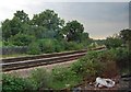
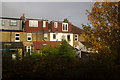
Lines divide
This line leaves the South West mainline and heads to Sutton.
Image: © N Chadwick
Taken: 2 Jul 2011
0.12 miles
2
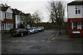
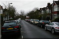
Midmoor Road, Wimbledon
Midmoor Road runs down to the railway line, and from its end a cycle path runs beside the track: signs for the cycle path can be seen at the foot of the low railway embankment.
Image: © Christopher Hilton
Taken: 26 Jan 2015
0.15 miles
6
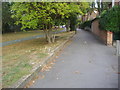
The Chase, Wimbledon
This has a separate cycle path, and is the place the eponymous Wimbledon Chase station is named after. Half is a road and then becomes a path for the easterly extreme.
Image: © David Howard
Taken: 28 Sep 2009
0.17 miles
7
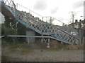
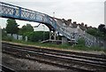
London : Wimbledon - Footbridge
The steps leading up to the footbridge and over the railway from Merton Hall Road.
Image: © Lewis Clarke
Taken: 4 Mar 2010
0.17 miles
8
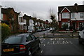
View down Pentney Road into Southdown Road, Wimbledon
Image: © Christopher Hilton
Taken: 26 Jan 2015
0.19 miles
9
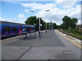
Wimbledon Chase station
The Wimbledon to Sutton line was first proposed in the early 1880s with the intention of stimulating house building across the clay pastures between the two towns, which up until then had remained largely untouched. Lack of enthusiasm or downright opposition from established railway companies, particularly the London, Brighton & South Coast Railway, prevented any progress until after the First World War. The LBSCR went to such lengths to prove there was no need for a railway north of Sutton that when a Parliamentary committee in 1910 was considering a Bill for the line they produced a lady who explained that she had once tried to hail a bus which used to run between Wimbledon and Sutton. The conductor was so surprised that he failed to signal to the driver to stop, and the driver turned round to see what the lady was waving at.
The line finally opened in 1930, nearly 50 years after it was first proposed. The Wimbledon to Sutton line was designed for electric trains, with many inclines and sharp curves, although it hardly justified the drivers' nickname for it: "Wall of Death". Wimbledon Chase, along with other stations on the line has a single central platform. A First Capital Connect train for Luton is just leaving.
Image: © Marathon
Taken: 22 Aug 2012
0.19 miles