
IMAGES TAKEN NEAR TO
Ernle Road, LONDON, SW20 0HL
Introduction
This page details the photographs taken nearby to Ernle Road, SW20 0HL by members of the Geograph project.
The Geograph project started in 2005 with the aim of publishing, organising and preserving representative images for every square kilometre of Great Britain, Ireland and the Isle of Man.

There are currently over 7.5m images from over14,400 individuals and you can help contribute to the project by visiting https://www.geograph.org.uk
Image Map
Images are licensed for reuse under creativecommons.org/licenses/by-sa/2.0
Notes
- Clicking on the map will re-center to the selected point.
- The higher the marker number, the further away the image location is from the centre of the postcode.
Image Listing (42 Images Found)
Images are licensed for reuse under creativecommons.org/licenses/by-sa/2.0
Image
Details
Distance
1
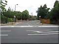
Junction of Ernie Road with Copse Hill, West Wimbledon
Image: © Richard Rogerson
Taken: 30 Jul 2010
0.04 miles
2
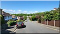
Wool Road
Residential road on a steep hill.
Image: © James Emmans
Taken: 8 May 2022
0.08 miles
3
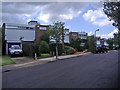
Cottenham Drive, West Wimbledon
Very well designed 1960s housing estate
Image: © David Howard
Taken: 29 Jul 2007
0.09 miles
4
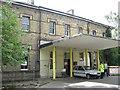
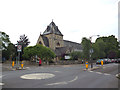
Atkinson Morley Hospital, Wimbledon
The hospital was opened in 1869 following a donation of £100,000 by Mr Atkinson Morley, a wealthy hotelier and landowner, to St George's Hospital "for receiving, maintaining, and generally assisting convalescent poor patients". Mr Atkinson Morley had been a medical student at St George's Hospital, Hyde Park Corner about 1800.
The hospital remained a convalescent home until 1939. During World War II, when the Bolingbroke and St. George’s acted as emergency hospitals for war casualties, the Neurosurgery Unit was established at the AMH by the neurosurgeon Sir Wylie McKissock. As the Regional Neurosciences Unit for South West London, the hospital even had its own helicopter landing facility. The hospital remained open until 2003. There are now plans to convert it to residential accommodation. http://en.wikipedia.org/wiki/Atkinson_Morley_Hospital
Image: © Richard Rogerson
Taken: 30 Jul 2010
0.14 miles
6
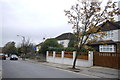
Houses on Copse Hill
These large detached houses are on the north side of Copse Hill opposite the old Atkinson Morley Hospital which is being developed into luxury housing by the Berkeley Group.
Image: © Nigel Mykura
Taken: 3 Dec 2015
0.16 miles
7
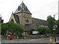
Christ Church, West Wimbledon
On Copse Hill at the junction with Cottenham Park Road (B281).
Image: © G Laird
Taken: 5 Jul 2012
0.16 miles
8
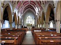
Christ Church, Copse Hill, West Wimbledon, London SW20 - East end
Image: © John Salmon
Taken: 21 May 2008
0.16 miles
9
Christ Church & Hall from Pepys Road, London SW20
Image: © John Salmon
Taken: 21 May 2008
0.16 miles
10
The Atkinson Morley Hospital
This is now closed and boarded up.
Image: © Bill Boaden
Taken: 14 Aug 2010
0.16 miles