
IMAGES TAKEN NEAR TO
Barham Road, LONDON, SW20 0ES
Introduction
This page details the photographs taken nearby to Barham Road, SW20 0ES by members of the Geograph project.
The Geograph project started in 2005 with the aim of publishing, organising and preserving representative images for every square kilometre of Great Britain, Ireland and the Isle of Man.

There are currently over 7.5m images from over14,400 individuals and you can help contribute to the project by visiting https://www.geograph.org.uk
Image Map
Images are licensed for reuse under creativecommons.org/licenses/by-sa/2.0
Notes
- Clicking on the map will re-center to the selected point.
- The higher the marker number, the further away the image location is from the centre of the postcode.
Image Listing (15 Images Found)
Images are licensed for reuse under creativecommons.org/licenses/by-sa/2.0
Image
Details
Distance
1
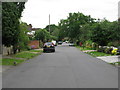
Drax Avenue, West Wimbledon
An avenue of private houses running parallel to Copse Hill.
Image: © G Laird
Taken: 5 Jul 2012
0.12 miles
2
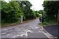
Almer Road
This is a private road running off Copse Hill.
Image: © Bill Boaden
Taken: 14 Aug 2010
0.14 miles
3
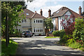
Lindisfarne Road, Copse Hill
This is affluent suburbia, with large detached houses on a cul-de-sac off Copse Hill close to Wimbledon Common and every other sort of amenity. Needless to say the properties here are not cheap.
Image: © Stephen McKay
Taken: 10 May 2018
0.14 miles
4
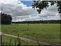
Beverly Meads
Grassland used by Wimbledon Rugby Football Club.
Image: © James Emmans
Taken: 31 Aug 2020
0.16 miles
5
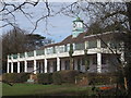
Oberon Pavilion, Cottenham Park
This cricket pavilion is on Lindisfarne Road.
This is used by the Old Wimbledonians (former pupils of Wimbledon College).
Image: © David Anstiss
Taken: 14 Apr 2013
0.18 miles
6
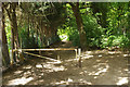
Path onto Wimbledon Common
The path is effectively an extension of Barham Road leading into the south-western corner of the common.
Image: © Stephen McKay
Taken: 10 May 2018
0.19 miles
7
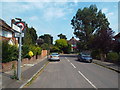
Burdett Avenue, near Raynes Park
Burdett Avenue is a residential road in the outer suburbs of south west London.
Image: © Malc McDonald
Taken: 1 Jul 2018
0.21 miles
8

Robin Hood Way (1)
Looking south along the A3 near Coombe. Taken from a footbridge at the end of Coombe Hill Road.
Image: © Stephen Richards
Taken: Unknown
0.22 miles
9
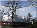
Wimbledon Hill Park development
This large building site (and tower crane) is on Copse Hill.
The development is part of the conversion of the former Atkinson Morley Hospital (AMH). The last section of the hospital was closed in 2012.
Image: © David Anstiss
Taken: 14 Apr 2013
0.23 miles
10
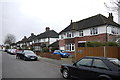
Houses in Burdett Avenue
The houses in this area tend to be large with significant extensions but with quite small gardens. Often the houses have been extended to such an extent that they cover nearly as much land as the garden. Prices in this area (January 2016) currently quoted on the market vary from £750,000 for a four bed semi to £2.25M for a seven bed detached.
Image: © Nigel Mykura
Taken: 3 Dec 2015
0.23 miles