IMAGES TAKEN NEAR TO
St. Mary's Road, LONDON, SW19 7BP
Introduction
This page details the photographs taken nearby to St. Mary's Road, SW19 7BP by members of the Geograph project.
The Geograph project started in 2005 with the aim of publishing, organising and preserving representative images for every square kilometre of Great Britain, Ireland and the Isle of Man.

There are currently over 7.5m images from over14,400 individuals and you can help contribute to the project by visiting https://www.geograph.org.uk
Image Map
Images are licensed for reuse under creativecommons.org/licenses/by-sa/2.0
Notes
- Clicking on the map will re-center to the selected point.
- The higher the marker number, the further away the image location is from the centre of the postcode.
Image Listing (117 Images Found)
Images are licensed for reuse under creativecommons.org/licenses/by-sa/2.0
Image
Details
Distance
1
Stop
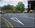
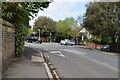
Police control the junction on Church Hill as people and traffic leave the tennis.
Image: © Steve Fareham
Taken: 27 Jun 2009
0.02 miles
2
St Mary's Churchyard, Wimbledon
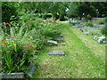
St Mary's Churchyard is located high up on the north-eastern edge of the old Wimbledon Village. There are fine views over Wimbledon Park. As would be expected, the churchyard lies in the heart of a series of large houses set in fine grounds. This small and attractive extension lies just to the south of the main churchyard and is accessed by a gate at one end.
Image: © Marathon
Taken: 25 Jul 2012
0.03 miles
3
Churchyard cat, Wimbledon
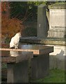
This cat in the churchyard of Image seems to have spotted its shadow on a nearby tomb.
Image: © Derek Harper
Taken: 16 Nov 2010
0.03 miles
5
St Mary's Churchyard, Wimbledon
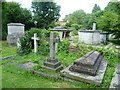
St Mary's Churchyard is located high up on the north-eastern edge of the old Wimbledon Village. There are fine views over Wimbledon Park. As would be expected, the churchyard lies in the heart of a series of large houses set in fine grounds. Some of the tombs in the churchyard reflect the wealth of the area.
Image: © Marathon
Taken: 25 Jul 2012
0.05 miles
6
Stag Lodge
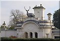
The former lodge to Wimbledon Park House, dating from 1850 and a private house since 1872. The current stag dates only from 1988, so is not mentioned in the listed building description written at that time http://www.britishlistedbuildings.co.uk/en-204989-stag-lodge-including-flanking-walls-and- . http://www.wimbledonhomesb-b.co.uk/In%20the%20area.htm
Image: © Derek Harper
Taken: 16 Nov 2010
0.05 miles
7

Between Courts 3 and 4
Looking between Courts 3 and 4 with Wimbledon church in the distance
Image: © Shaun Ferguson
Taken: 25 Jun 2007
0.06 miles
8

Spurge, Dairy Walk
Frost has melted to forms water drops on the silky leaves of this Euphorbia, by the eastern end of the footpath that runs parallel to Burghley Road.
Image: © Derek Harper
Taken: 16 Nov 2010
0.06 miles
9
House in Wimbledon Village
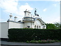
St Mary's Church is located high up on the north-eastern edge of the old Wimbledon Village. There are fine views over Wimbledon Park. As would be expected, the churchyard lies in the heart of a series of large houses set in fine grounds. This house directly opposite on the corner of Arthur Road by the approach to the church is not the largest but is certainly one of the more unusual.
Image: © Marathon
Taken: 25 Jul 2012
0.06 miles