
IMAGES TAKEN NEAR TO
Parkside, LONDON, SW19 5NB
Introduction
This page details the photographs taken nearby to Parkside, SW19 5NB by members of the Geograph project.
The Geograph project started in 2005 with the aim of publishing, organising and preserving representative images for every square kilometre of Great Britain, Ireland and the Isle of Man.

There are currently over 7.5m images from over14,400 individuals and you can help contribute to the project by visiting https://www.geograph.org.uk
Image Map
Images are licensed for reuse under creativecommons.org/licenses/by-sa/2.0
Notes
- Clicking on the map will re-center to the selected point.
- The higher the marker number, the further away the image location is from the centre of the postcode.
Image Listing (34 Images Found)
Images are licensed for reuse under creativecommons.org/licenses/by-sa/2.0
Image
Details
Distance
1

Nurses' Walk
Another view along the misty path shown in Image, separated from Parkside by stout trees.
Image: © Derek Harper
Taken: 16 Nov 2010
0.05 miles
2

Bluegate Gravel Pit
The name of Bluegate Gravel Pit gives away its origin. Although it is very close to the busy Parkside, it is less visited than the three other major ponds on Wimbledon Common and Putney Heath: Rushmere, Queen's Mere and King's Mere. Bluegate Gravel Pit is largely surrounded by trees and in dry summers and autumns it mostly dries up. The summer of 2012 was anything but dry so that although this was a hot day, there was still quite a bit of water.
Image: © Marathon
Taken: 25 Jul 2012
0.08 miles
3
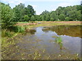
Bluegate Gravel Pit
The name of Bluegate Gravel Pit gives away its origin. Although it is very close to the busy Parkside, it is less visited than the three other major ponds on Wimbledon Common and Putney Heath: Rushmere, Queen's Mere and King's Mere. Bluegate Gravel Pit is largely surrounded by trees and in dry summers and autumns it mostly dries up. The summer of 2012 was anything but dry so that although this was a hot day, there was still quite a bit of water.
Image: © Marathon
Taken: 25 Jul 2012
0.10 miles
4
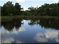
Old Bluegate Gravel pit Lake
Old Bluegate Gravel pit Lake on the SE edge of Wimbledon Common
Image: © Shaun Ferguson
Taken: 25 Jun 2008
0.10 miles
5
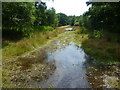
Bluegate Gravel Pit
The name of Bluegate Gravel Pit gives away its origin. Although it is very close to the busy Parkside, it is less visited than the three other major ponds on Wimbledon Common and Putney Heath: Rushmere, Queen's Mere and King's Mere. Bluegate Gravel Pit is largely surrounded by trees and in dry summers and autumns it mostly dries up. The summer of 2012 was anything but dry so that although this was a hot day, there was still quite a bit of water. This channel connects the northern half, where I am standing, with the southern half.
Image: © Marathon
Taken: 25 Jul 2012
0.10 miles
6
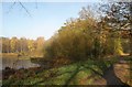
Bluegate Pond
This northern part is also shown in Image With Nurses' Walk on the right.
Image: © Derek Harper
Taken: 16 Nov 2010
0.11 miles
7
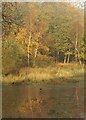
Bluegate Pond
See Image; here a lone crow tackles the ice on the surface of the southwestern corner of the pond, with autumnal trees on the common behind.
Image: © Derek Harper
Taken: 16 Nov 2010
0.12 miles
8
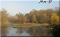
Bluegate Pond
The southern part of the pond, with crows pecking at the ice; see also Image
Image: © Derek Harper
Taken: 16 Nov 2010
0.12 miles
9
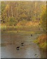
Crows on Bluegate Pond
Crows peck at the ice to get at trapped food, on the southern of the two parts of the pond.
Image: © Derek Harper
Taken: 16 Nov 2010
0.12 miles
10
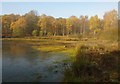
Bluegate Pond
The pond on Wimbledon Common, also shown in Image, is frozen, though bright sunshine is doing its best. The yellow area at the edge of the pond is the invasive New Zealand Pygmyweed, also known as Australian Swamp Stonecrop (Crassula helmsii) - thanks to Mick Crawley for identifying it.
Image: © Derek Harper
Taken: 16 Nov 2010
0.12 miles