
IMAGES TAKEN NEAR TO
Erridge Road, LONDON, SW19 3JA
Introduction
This page details the photographs taken nearby to Erridge Road, SW19 3JA by members of the Geograph project.
The Geograph project started in 2005 with the aim of publishing, organising and preserving representative images for every square kilometre of Great Britain, Ireland and the Isle of Man.

There are currently over 7.5m images from over14,400 individuals and you can help contribute to the project by visiting https://www.geograph.org.uk
Image Map
Images are licensed for reuse under creativecommons.org/licenses/by-sa/2.0
Notes
- Clicking on the map will re-center to the selected point.
- The higher the marker number, the further away the image location is from the centre of the postcode.
Image Listing (111 Images Found)
Images are licensed for reuse under creativecommons.org/licenses/by-sa/2.0
Image
Details
Distance
1

Croydon Tram at Kingston Road/Hartfield Road junction
Image: © Noel Foster
Taken: 14 Jun 2005
0.10 miles
2
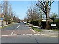
Poplar Road
A sports ground is on the right.
Image: © Robin Webster
Taken: 1 Apr 2012
0.13 miles

6
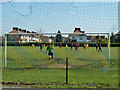
Sunday morning football
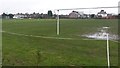
The playing field seems to belong to the Old Rutlishians Association. It is surrounded with high netting.
Image: © Robin Webster
Taken: 1 Apr 2012
0.17 miles
7
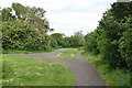
Kendor Gardens
Kendor Gardens is a linear park to the north of Morden Underground station. The Northern line runs beneath the park, and trains can sometimes be heard rumbling below.
Image: © N Chadwick
Taken: 21 May 2023
0.17 miles
9
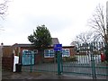
Merton Park Primary School: early February 2018
Image: © Basher Eyre
Taken: 3 Feb 2018
0.18 miles
10
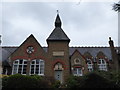
Former school opposite St Mary's Church
(now flats)
Image: © Basher Eyre
Taken: 3 Feb 2018
0.18 miles