IMAGES TAKEN NEAR TO
Gressenhall Road, LONDON, SW18 5QJ
Introduction
This page details the photographs taken nearby to Gressenhall Road, SW18 5QJ by members of the Geograph project.
The Geograph project started in 2005 with the aim of publishing, organising and preserving representative images for every square kilometre of Great Britain, Ireland and the Isle of Man.

There are currently over 7.5m images from over14,400 individuals and you can help contribute to the project by visiting https://www.geograph.org.uk
Image Map
Images are licensed for reuse under creativecommons.org/licenses/by-sa/2.0
Notes
- Clicking on the map will re-center to the selected point.
- The higher the marker number, the further away the image location is from the centre of the postcode.
Image Listing (45 Images Found)
Images are licensed for reuse under creativecommons.org/licenses/by-sa/2.0
Image
Details
Distance
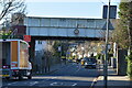
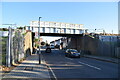
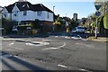
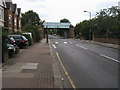
4
Granville Road, near Southfields
Granville Road is a residential road in south west London.
The bridge in the background carries the Wimbledon branch of London Underground's District Line across the road.
Image: © Malc McDonald
Taken: 9 Jul 2016
0.05 miles
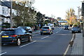
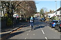
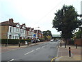
6
Granville Road
Granville Road heading under the District line railway bridge
Image: © Shaun Ferguson
Taken: 10 Jul 2009
0.05 miles
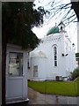
7
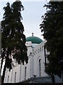
Dome, London Mosque, Gressenhall Road SW18
Image: © Robin Sones
Taken: 14 Dec 2012
0.06 miles
8
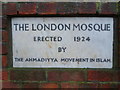
Wall plaque, London Mosque, Gressenhall Road SW18
Image: © Robin Sones
Taken: 14 Dec 2012
0.07 miles