
IMAGES TAKEN NEAR TO
Swaby Road, LONDON, SW18 3QZ
Introduction
This page details the photographs taken nearby to Swaby Road, SW18 3QZ by members of the Geograph project.
The Geograph project started in 2005 with the aim of publishing, organising and preserving representative images for every square kilometre of Great Britain, Ireland and the Isle of Man.

There are currently over 7.5m images from over14,400 individuals and you can help contribute to the project by visiting https://www.geograph.org.uk
Image Map
Images are licensed for reuse under creativecommons.org/licenses/by-sa/2.0
Notes
- Clicking on the map will re-center to the selected point.
- The higher the marker number, the further away the image location is from the centre of the postcode.
Image Listing (79 Images Found)
Images are licensed for reuse under creativecommons.org/licenses/by-sa/2.0
Image
Details
Distance
1
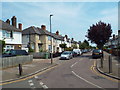
Lidiard Road, near Earlsfield
Lidiard Road is a narrow residential street in the suburbs of south London.
Image: © Malc McDonald
Taken: 1 Jul 2018
0.06 miles
2

Electricity sub station, Littleton Street
Image: © Alex McGregor
Taken: 5 Mar 2015
0.06 miles
3

Aldrich Terrace, near Earlsfield
Aldrich Terrace is a short residential street in the suburbs of south London.
Image: © Malc McDonald
Taken: 1 Jul 2018
0.06 miles
4
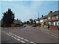
Headington Road, near Earlsfield
Headington Road is a residential street in the suburbs of south London.
Image: © Malc McDonald
Taken: 1 Jul 2018
0.08 miles
5
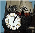
St Andrew's Church Clock in Earlsfield, Greater London
St Andrew's Church Clock in Earlsfield, Greater London was erected on 8th February 1911.
Image: © John P Reeves
Taken: 7 Apr 2011
0.15 miles
6
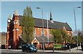
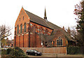
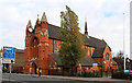
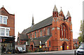
St Andrew's Church in Earlsfield, Greater London
St Andrew's Church in Earlsfield, Greater London as viewed from the A217 main road. Saint Andrew’s Church is a Grade II listed building. It was built in 1890 to the designs of the architect E. W. Mountford, in the Victorian Gothic style. It has been admired by Sir John Betjeman, among others, and contains fine examples of metalwork and brickwork.
Image: © John P Reeves
Taken: 7 Apr 2011
0.15 miles
10
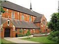
St Andrew's church garden, Earlsfield
One of several churches along Garratt Lane, this one is Anglican and dates from 1890 (extended 1902). Listed grade 2 (list entry number 1380228). The community garden was created c.2011 - see Image
Image: © Stephen Craven
Taken: 20 Jun 2014
0.15 miles