
IMAGES TAKEN NEAR TO
Algarve Road, LONDON, SW18 3EG
Introduction
This page details the photographs taken nearby to Algarve Road, SW18 3EG by members of the Geograph project.
The Geograph project started in 2005 with the aim of publishing, organising and preserving representative images for every square kilometre of Great Britain, Ireland and the Isle of Man.

There are currently over 7.5m images from over14,400 individuals and you can help contribute to the project by visiting https://www.geograph.org.uk
Image Map
Images are licensed for reuse under creativecommons.org/licenses/by-sa/2.0
Notes
- Clicking on the map will re-center to the selected point.
- The higher the marker number, the further away the image location is from the centre of the postcode.
Image Listing (114 Images Found)
Images are licensed for reuse under creativecommons.org/licenses/by-sa/2.0
Image
Details
Distance
1
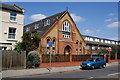
Former church on Earlsfield Road
Now converted into flats.
Image: © Bill Boaden
Taken: 30 Jul 2011
0.03 miles
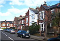
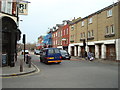
4
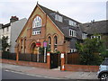
Earsfield: Former church converted into apartments
Image: © Dr Neil Clifton
Taken: 12 Jul 2013
0.04 miles
6
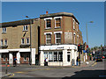
Ghost sign on Garratt Lane
A faded sign on the brickwork of a building on the corner of Garratt Lane and Earlsfield Road. It seems to read "S P Q & ...". The building was (as of 2011) an estate agent's office.
Image: © Stephen Craven
Taken: 8 Apr 2011
0.08 miles
8
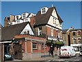
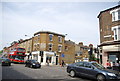
The Wandle pub
This pub on the corner of Penwith Road (foreground) and Garratt Lane appears to have changed its name within the last 3 years, as it appears in a 2008 photos as the Puzzle Pub. The current name is more geographically relevant, as the river Wandle flows nearby Image
In the foreground, note the ASL (cycle box) for the road junction, unusually sited on a speed hump!
Image: © Stephen Craven
Taken: 8 Apr 2011
0.08 miles
9
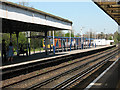
Earlsfield Station: island platform
The nearer face of the island platform in this photo is platform 2 (up slow line) for stopping services to Waterloo.
The far side is the rarely used platform 1 on the down fast line. In this photo a class 450 electric unit passes through without stopping. Note the later, lower extension to the original canopy.
Image: © Stephen Craven
Taken: 8 Apr 2011
0.08 miles
10
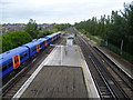
Earlsfield station and tracks towards Clapham Junction
This is the view from a temporary footbridge linking the platforms whilst the main entrance was closed and looks towards Clapham Junction. The station was opened by the London & South Western Railway and the name 'Earlsfield' originated from the name of the large Victorian residence which was on the present site of the station. When the site was sold by the Davis family to the railway company, one of the conditions of sale was that the station would be called 'Earlsfield'.
Image: © Marathon
Taken: 5 Oct 2011
0.08 miles