
IMAGES TAKEN NEAR TO
Earlsfield Road, LONDON, SW18 3DY
Introduction
This page details the photographs taken nearby to Earlsfield Road, SW18 3DY by members of the Geograph project.
The Geograph project started in 2005 with the aim of publishing, organising and preserving representative images for every square kilometre of Great Britain, Ireland and the Isle of Man.

There are currently over 7.5m images from over14,400 individuals and you can help contribute to the project by visiting https://www.geograph.org.uk
Image Map
Images are licensed for reuse under creativecommons.org/licenses/by-sa/2.0
Notes
- Clicking on the map will re-center to the selected point.
- The higher the marker number, the further away the image location is from the centre of the postcode.
Image Listing (97 Images Found)
Images are licensed for reuse under creativecommons.org/licenses/by-sa/2.0
Image
Details
Distance
1
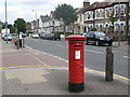
Earlsfield Road / Cargill Road, SW18
Shows the location of Image
Image: © Mike Quinn
Taken: 23 Jul 2008
0.03 miles
2
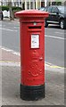
Edward VII postbox, Earlsfield Road / Cargill Road, SW18
The location of this postbox is shown in Image
Image: © Mike Quinn
Taken: 23 Jul 2008
0.03 miles
3
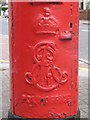
Edward VII postbox, Earlsfield Road / Cargill Road, SW18 - royal cipher
See Image
Image: © Mike Quinn
Taken: 23 Jul 2008
0.05 miles
5
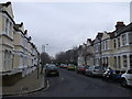
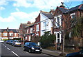
Atheldene Road, Earlsfield
Long road of terraced housing, leading around a bend towards Farlton Road.
Image: © David Anstiss
Taken: 30 Dec 2012
0.10 miles
6
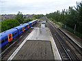
Earlsfield station and tracks towards Clapham Junction
This is the view from a temporary footbridge linking the platforms whilst the main entrance was closed and looks towards Clapham Junction. The station was opened by the London & South Western Railway and the name 'Earlsfield' originated from the name of the large Victorian residence which was on the present site of the station. When the site was sold by the Davis family to the railway company, one of the conditions of sale was that the station would be called 'Earlsfield'.
Image: © Marathon
Taken: 5 Oct 2011
0.10 miles
7

Trees by the line near Wandsworth Cemetery
Image: © N Chadwick
Taken: 2 Jul 2011
0.11 miles
9
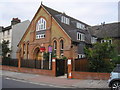
Earsfield: Former church converted into apartments
Image: © Dr Neil Clifton
Taken: 12 Jul 2013
0.12 miles
