
IMAGES TAKEN NEAR TO
Armoury Way, SW18 1TH
Introduction
This page details the photographs taken nearby to Armoury Way, SW18 1TH by members of the Geograph project.
The Geograph project started in 2005 with the aim of publishing, organising and preserving representative images for every square kilometre of Great Britain, Ireland and the Isle of Man.

There are currently over 7.5m images from over14,400 individuals and you can help contribute to the project by visiting https://www.geograph.org.uk
Image Map
Images are licensed for reuse under creativecommons.org/licenses/by-sa/2.0
Notes
- Clicking on the map will re-center to the selected point.
- The higher the marker number, the further away the image location is from the centre of the postcode.
Image Listing (296 Images Found)
Images are licensed for reuse under creativecommons.org/licenses/by-sa/2.0
Image
Details
Distance
1
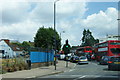
Armoury Way, Wandsworth
Part of a gyratory system on the South Circular Road. You cannot expect the traffic to move very fast.
Image: © Bill Boaden
Taken: 1 Aug 2014
0.03 miles
2
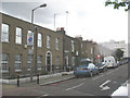
Barchard Street, Wandsworth
The street is typical of the terraces in this now 'gentrified' area of Wandsworth.
Image: © Stephen Craven
Taken: 1 May 2008
0.03 miles
3

Motor service centre, Wandsworth
In the shadow of Image, this is at the east end of Armoury Way.
Image: © Derek Harper
Taken: 30 Nov 2009
0.03 miles
4

The Salvation Army Citadel at Ram Street in Wandsworth
Image: © tristan forward
Taken: 30 Aug 2010
0.03 miles
5
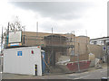
Salvation Army hall (under construction)
A new church and community hall for the Salvation Army being built on Ram Street.
Image: © Stephen Craven
Taken: 1 May 2008
0.03 miles
6
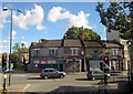
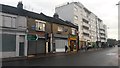
Shops on Fairfield Street, Wandsworth
As we sat on the top deck of a number 189 bus, my wife observed that this row of buildings looked a likely candidate for demolition, so I thought I should capture it. Image is already on the site, but this view is from a different angle. None of the premises seem to be operating, from Zodiac Records (open in 2004) on the left to the Persian restaurant on the right (open in 2009).
Image: © Derek Harper
Taken: 14 Oct 2012
0.03 miles
7
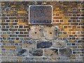
Relics of the Surrey Iron Railway, built into the wall of the Ram Brewery, Wandsworth
The plaque reads as follows:
'The Surrey Iron Railway was the first public railway in England, probably in the world. The railway ran along this road on its route from Croydon to the mouth of the River Wandle, a distance of nearly nine miles. Goods wagons were pulled by horses along a track of cast iron plates laid on stone sleepers, some of which are set in the wall below. The gauge was 4'2".
It opened in 1803, following the passing of the Surrey Iron Railway Act in 1801, and closed in 1846, the victim of the success of newer railways, powered by steam.
Wandsworth Society 1994'
The plaque and sleepers are to be found on the west side of York Road, not far from its junction with Armoury Way.
Image: © Stefan Czapski
Taken: 8 Jan 2011
0.04 miles
8
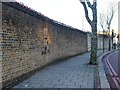
Site of a plaque commemorating the Surrey Iron Railway, York Road, Wandsworth
Looking north along the wall of the former Ram Brewery, in York Road, Wandsworth. Set into the wall near the plane tree are a number of stone sleepers, relics of the old Surrey Iron Railway which once ran along here to its terminus on the banks of the River Wandle, nearby. This railway is reckoned to have been the first in England to be opened for public use, in 1801. What is often overlooked is that railways (of a sort) were in use for industrial purposes long before the Steam Age. In the Nottingham area - so it is said - a railway (or tramway) was being used to transport coal as early as 1597.
For the text displayed on the plaque, see: Image
Image: © Stefan Czapski
Taken: 8 Jan 2011
0.04 miles
10
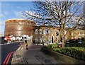
Barchard Street, Wandsworth
Image: © Derek Harper
Taken: 30 Nov 2009
0.05 miles