IMAGES TAKEN NEAR TO
Upper Tooting Road, LONDON, SW17 7ER
Introduction
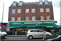
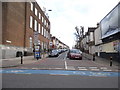
This page details the photographs taken nearby to Upper Tooting Road, SW17 7ER by members of the Geograph project.
The Geograph project started in 2005 with the aim of publishing, organising and preserving representative images for every square kilometre of Great Britain, Ireland and the Isle of Man.

There are currently over 7.5m images from over14,400 individuals and you can help contribute to the project by visiting https://www.geograph.org.uk
Image Map
Images are licensed for reuse under creativecommons.org/licenses/by-sa/2.0
Notes
- Clicking on the map will re-center to the selected point.
- The higher the marker number, the further away the image location is from the centre of the postcode.
Image Listing (107 Images Found)
Images are licensed for reuse under creativecommons.org/licenses/by-sa/2.0
Image
Details
Distance
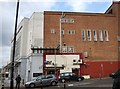


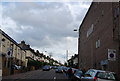
5
Brudenell Road at the junction of Upper Tooting Road
The telephone exchange is on the left, most in London look exactly the same as this.
Image: © David Howard
Taken: 5 Apr 2015
0.03 miles