IMAGES TAKEN NEAR TO
Henry Doulton Drive, LONDON, SW17 6DD
Introduction
This page details the photographs taken nearby to Henry Doulton Drive, SW17 6DD by members of the Geograph project.
The Geograph project started in 2005 with the aim of publishing, organising and preserving representative images for every square kilometre of Great Britain, Ireland and the Isle of Man.

There are currently over 7.5m images from over14,400 individuals and you can help contribute to the project by visiting https://www.geograph.org.uk
Image Map (Loading...)


Getting Data...Please wait
Leaflet Map data © OpenStreetMap
Images are licensed for reuse under creativecommons.org/licenses/by-sa/2.0
Notes
- Clicking on the map will re-center to the selected point.
- The higher the marker number, the further away the image location is from the centre of the postcode.
Image Listing (67 Images Found)
Images are licensed for reuse under creativecommons.org/licenses/by-sa/2.0
Image
Details
Distance
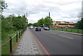
1
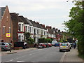
Franciscan Road
The Northern end of Franciscan Road looking south.
Image: © Oxyman
Taken: 24 Apr 2007
0.09 miles
4

Massingberd Way
Autumn foliage by the spine road cutting through this housing estate by Tooting Graveney Common.
Image: © Colin Smith
Taken: 19 Oct 2008
0.11 miles
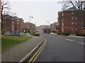
5

Elderfield Place
Modern blocks of flats, on a housing estate, beside Tooting Graveney Common.
Image: © Colin Smith
Taken: 19 Oct 2008
0.12 miles
7

Lisle Close
Cul-de-sac of apartment blocks on a modern housing estate by Tooting Graveney Common.
Image: © Colin Smith
Taken: 19 Oct 2008
0.13 miles
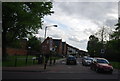
9
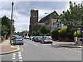
All Saints Church
On Brudenell Road All Saints Church
Image: © Shaun Ferguson
Taken: 10 Jul 2009
0.16 miles
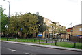
10
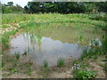
The Old Yachting Pond, Tooting Graveney Common
Sometime around 1990, The Old Yachting Pond was enlarged and planted with a variety of wetland species. A boardwalk was added around the edge, and the whole was quite a transformation from its rather formal predecessor. Towards the end of the dry spell in summer 2010, there was no sign of any water and the boardwalk was left high and dry - see http://www.geograph.org.uk/photo/2058707 At the end of the summer of 2014 seen here, there was some water but it was very far from filling up to the edge of the boardwalk seen in the earlier photograph.
Image: © Marathon
Taken: 17 Sep 2014
0.16 miles