IMAGES TAKEN NEAR TO
Brookview Road, LONDON, SW16 6UA
Introduction
This page details the photographs taken nearby to Brookview Road, SW16 6UA by members of the Geograph project.
The Geograph project started in 2005 with the aim of publishing, organising and preserving representative images for every square kilometre of Great Britain, Ireland and the Isle of Man.

There are currently over 7.5m images from over14,400 individuals and you can help contribute to the project by visiting https://www.geograph.org.uk
Image Map
Images are licensed for reuse under creativecommons.org/licenses/by-sa/2.0
Notes
- Clicking on the map will re-center to the selected point.
- The higher the marker number, the further away the image location is from the centre of the postcode.
Image Listing (53 Images Found)
Images are licensed for reuse under creativecommons.org/licenses/by-sa/2.0
Image
Details
Distance
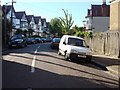
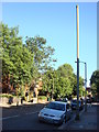
5
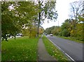
Furzedown Road
Unclassified road from Streatham Park to Rectory Lane, crossing Tooting Graveney Common.
Image: © Mike Faherty
Taken: 23 Nov 2013
0.07 miles
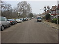
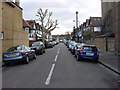
10
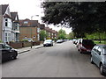
Clairview Road
Clairview Road is refreshingly free of cars which is unusual for the area
Image: © Oxyman
Taken: 24 Apr 2007
0.10 miles