IMAGES TAKEN NEAR TO
Pathfield Road, LONDON, SW16 5NU
Introduction
This page details the photographs taken nearby to Pathfield Road, SW16 5NU by members of the Geograph project.
The Geograph project started in 2005 with the aim of publishing, organising and preserving representative images for every square kilometre of Great Britain, Ireland and the Isle of Man.

There are currently over 7.5m images from over14,400 individuals and you can help contribute to the project by visiting https://www.geograph.org.uk
Image Map
Images are licensed for reuse under creativecommons.org/licenses/by-sa/2.0
Notes
- Clicking on the map will re-center to the selected point.
- The higher the marker number, the further away the image location is from the centre of the postcode.
Image Listing (117 Images Found)
Images are licensed for reuse under creativecommons.org/licenses/by-sa/2.0
Image
Details
Distance
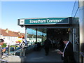
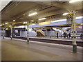
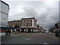
2
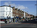
Greyhound Lane
Parade of shops on Greyhound Lane
Image: © Malc McDonald
Taken: 6 Mar 2010
0.03 miles
7
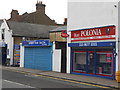
Estreham Road: Polish and English small businesses
Image: © Andrew Wilson
Taken: 15 Oct 2013
0.07 miles
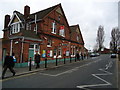
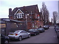
9
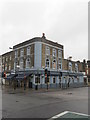
The railway public house, near Streatham Common Station
Image: © Richard Rogerson
Taken: 30 May 2013
0.07 miles