IMAGES TAKEN NEAR TO
Kintyre Close, LONDON, SW16 4SF
Introduction
This page details the photographs taken nearby to Kintyre Close, SW16 4SF by members of the Geograph project.
The Geograph project started in 2005 with the aim of publishing, organising and preserving representative images for every square kilometre of Great Britain, Ireland and the Isle of Man.

There are currently over 7.5m images from over14,400 individuals and you can help contribute to the project by visiting https://www.geograph.org.uk
Image Map
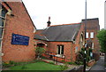
Images are licensed for reuse under creativecommons.org/licenses/by-sa/2.0
Notes
- Clicking on the map will re-center to the selected point.
- The higher the marker number, the further away the image location is from the centre of the postcode.
Image Listing (76 Images Found)
Images are licensed for reuse under creativecommons.org/licenses/by-sa/2.0
Image
Details
Distance

7
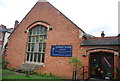
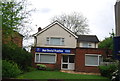
Jazz Dental Practice
Is this just a name or a description of the style of service.
Image: © Bill Boaden
Taken: 2 Aug 2014
0.06 miles
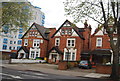
8
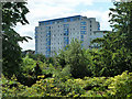
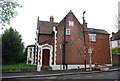
Solent Court
The block of flats looms above the vegetation of Norbury Hall park. It is accessed from the other side, on London Road.
Image: © Robin Webster
Taken: 1 Jul 2011
0.06 miles