1
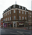
St Helen's Road, Norbury
This part is one-way. A small green is on the right.
Image: © Robin Webster
Taken: 19 Apr 2019
0.02 miles
2
St Helen's Road (E) bus stop, St Helen's Road, Norbury
Towards Streatham, which involves a right turn ahead.
Image: © Robin Webster
Taken: 19 Apr 2019
0.04 miles
3
Green alongside St Helen's Road
This small triangular green is bounded by St Helen's Road (to the right here), St Helen's Crescent, and Norbury Crescent which can be seen ahead.
Image: © Marathon
Taken: 25 Feb 2015
0.04 miles
4
Bank and Shops, London Road
A fine mid Victorian corner and terrace on London Road.
Listing details :- http://www.britishlistedbuildings.co.uk/en-201222-barclays-bank-greater-london-authority#.VwUVCHjFvVo
Image: © Des Blenkinsopp
Taken: 31 Mar 2015
0.05 miles
5
Barclay's Bank, Norbury
Norbury Crescent round round behind, making this a narrow corner bank.
Image: © Bill Boaden
Taken: 2 Aug 2014
0.07 miles
6
Norbury station
The Balham Hill & East Croydon line was constructed by the London Brighton & South Coast Railway as a short-cut on the Brighton Main Line to Victoria, avoiding Crystal Palace and Norwood Junction. The line was opened on 1st December 1862, but Norbury station was not opened until January 1878, as the surrounding area was quite rural. The station was rebuilt in 1903 when the lines were quadrupled. A nature area has been created on the middle platform as can be seen here. The fast lines are to the right of the middle platform and stopping trains use those to the left.
Image: © Marathon
Taken: 31 Aug 2011
0.07 miles
7
Norbury Railway Station
Image: © Stacey Harris
Taken: 8 Nov 2008
0.07 miles
8
Barclays Bank, Norbury
Grade II listed bank on the junction of the A23 London Road (in front) and Norbury Crescent (on the left).
See http://www.britishlistedbuildings.co.uk/en-201222-barclays-bank-1434-croydon for more details about the building.
Image: © David Anstiss
Taken: 30 Oct 2011
0.08 miles
9
London Road (A23), Norbury
The street numbers in London Road get rather high here, exceeding 1500 before the railway bridge ahead.
Image: © Robin Webster
Taken: 19 Apr 2019
0.08 miles
10
Norbury Telephone Exchange
The ground floor was once Norbury's post office, currently reduced to a take-away pizza establishment, a paradigm of the decline of British public services. Architect: Archibald Scott of the Office of Works.
Image: © Jim Osley
Taken: 9 Feb 2013
0.08 miles


