1
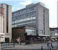
A23, Streatham High Road, SW16
By the Horse and Groom on the left.
Image: © Robin Webster
Taken: 19 Apr 2019
0.02 miles
2
Streatham, former cinema
Former ABC Cinema on Streatham High Road; listed by English Heritage. http://www.imagesofengland.org.uk/Details/Default.aspx?id=471321&mode=adv
Image: © Mike Faherty
Taken: 18 Aug 2012
0.02 miles
3
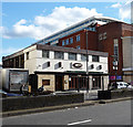
A23, Streatham High Road, SW16
A view north from the Mount Ephraim Road bus stop.
Image: © Robin Webster
Taken: 19 Apr 2019
0.03 miles
4
Norwich House, Streatham High Road
One of relatively few office blocks on the High Road, this one was built c1970 to the designs of Scott, Brownrigg and Turner. The ground floor shops and storey above are part of the same development. It is within the Streatham High Road and Streatham Hill Conservation Area, though the report describes Norfolk House as a "neutral building".
The course of Streatham High Road has been a major highway between London and Sussex since Roman times. Its current appearance is largely attributable to two major spells of development. The first was during the late C19th following the opening of Streatham Hill station in 1856, and the second was after 1911 when the line to Victoria was electrified. Though much-maligned and undoubtedly blighted by heavy traffic, closer examination reveals that the road is lined with a number of interesting buildings, some of which reflect the period between the wars when Streatham was a fashionable centre of entertainment. Information from Lambeth Council (http://www.lambeth.gov.uk/NR/exeres/CE4B5CE1-0387-40ED-B5A9-273A5160C34A.htm ).
Image: © Stephen Richards
Taken: Unknown
0.03 miles
5
Streatham High Road, November 1978
View north with ABC cinema on the right. This has now been converted into flats although the foyer and street frontage have been preserved.
Image: © Brian Whittle
Taken: Unknown
0.03 miles
6
13-19 Caton Mansions, Streatham High Road
A small block of flats above shops at street level dating from c1940 and named after the house, Caton Lodge, which formerly stood on the site. It is within the Streatham High Road and Streatham Hill Conservation Area.
The course of Streatham High Road has been a major highway between London and Sussex since Roman times. Its current appearance is largely attributable to two major spells of development. The first was during the late C19th following the opening of Streatham Hill station in 1856, and the second was after 1911 when the line to Victoria was electrified. Though much-maligned and undoubtedly blighted by heavy traffic, closer examination reveals that the road is lined with a number of interesting buildings, some of which reflect the period between the wars when Streatham was a fashionable centre of entertainment. Information from Lambeth Council (http://www.lambeth.gov.uk/NR/exeres/CE4B5CE1-0387-40ED-B5A9-273A5160C34A.htm ).
Image: © Stephen Richards
Taken: Unknown
0.03 miles
7
Streatham, Five Bells
Pub on Streatham High Road. Internally, bar right, drinking areas front and back on different levels; TV, games machines, darts. Cask ales on offer at my visit: Greene King IPA, Morland Old Speckled Hen. For some customer comments, see http://www.beerintheevening.com/pubs/s/37/3737/Five_Bells/Streatham
Image: © Mike Faherty
Taken: 18 Aug 2012
0.03 miles
8
Former ABC Cinema, Streatham High Road
This facade and the foyer behind are all that remain of the cinema, which closed in 2000 with the auditorium demolished in 2004 and flats built behind the facade. The cinema was designed by ABC's architect, William Riddell Glen, and built in 1938 as the Regal. The facade and foyer are Grade II listed. The citation comments that "this is a particularly striking survival for the quality of its facade, and especially of its double-height foyer which survives almost unaltered." Though in good condition it is on English Heritage's Heritage at Risk Register because no alternative use has been identified. It is within the Streatham High Road and Streatham Hill Conservation Area.
The course of Streatham High Road has been a major highway between London and Sussex since Roman times. Its current appearance is largely attributable to two major spells of development. The first was during the late C19th following the opening of Streatham Hill station in 1856, and the second was after 1911 when the line to Victoria was electrified. Though much-maligned and undoubtedly blighted by heavy traffic, closer examination reveals that the road is lined with a number of interesting buildings, some of which reflect the period between the wars when Streatham was a fashionable centre of entertainment. Information from Lambeth Council (http://www.lambeth.gov.uk/NR/exeres/CE4B5CE1-0387-40ED-B5A9-273A5160C34A.htm ).
Image: © Stephen Richards
Taken: Unknown
0.03 miles
9
Streatham: The 'Horse and Groom'
On the west side of Streatham High Road.
Image: © Dr Neil Clifton
Taken: 13 Jul 2012
0.04 miles
10
Former Genevieve, Streatham High Road
This was originally the Genevieve pub, named after the film about a vintage car. It is now a restaurant and bar. It was designed in 1967 by Collins Ltd on behalf of ABC Cinemas (the neighbouring cinema is partly visible). It is within the Streatham High Road and Streatham Hill Conservation Area, though the report describes the building as a "neutral area" which "looks out of place amidst the generally taller buildings which line the High Road".
The course of Streatham High Road has been a major highway between London and Sussex since Roman times. Its current appearance is largely attributable to two major spells of development. The first was during the late C19th following the opening of Streatham Hill station in 1856, and the second was after 1911 when the line to Victoria was electrified. Though much-maligned and undoubtedly blighted by heavy traffic, closer examination reveals that the road is lined with a number of interesting buildings, some of which reflect the period between the wars when Streatham was a fashionable centre of entertainment. Information from Lambeth Council (http://www.lambeth.gov.uk/NR/exeres/CE4B5CE1-0387-40ED-B5A9-273A5160C34A.htm ).
Image: © Stephen Richards
Taken: Unknown
0.04 miles


