
IMAGES TAKEN NEAR TO
Barnes Avenue, LONDON, SW13 9AJ
Introduction
This page details the photographs taken nearby to Barnes Avenue, SW13 9AJ by members of the Geograph project.
The Geograph project started in 2005 with the aim of publishing, organising and preserving representative images for every square kilometre of Great Britain, Ireland and the Isle of Man.

There are currently over 7.5m images from over14,400 individuals and you can help contribute to the project by visiting https://www.geograph.org.uk
Image Map
Images are licensed for reuse under creativecommons.org/licenses/by-sa/2.0
Notes
- Clicking on the map will re-center to the selected point.
- The higher the marker number, the further away the image location is from the centre of the postcode.
Image Listing (40 Images Found)
Images are licensed for reuse under creativecommons.org/licenses/by-sa/2.0
Image
Details
Distance
1
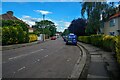
Barnes : Kentwode Green
Looking along a small road.
Image: © Lewis Clarke
Taken: 27 Jun 2022
0.06 miles
2
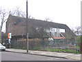
Castelnau community centre, Barnes
Originally the Castelnau Estate Church, One of the "Twenty Five New Churches" of South London between WW1 and WW2 (bibliography: ISBN 0 85244 313 7) and now a local-authority run community centre on Stillingfleet Road
Image: © Stephen Craven
Taken: 30 Jan 2007
0.06 miles
3
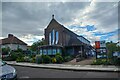
Barnes : Castelnau Community Centre
Looking towards the centre on Stillingfleet Road.
Image: © Lewis Clarke
Taken: 27 Jun 2022
0.07 miles
4
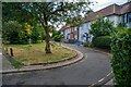
Barnes : Kentwode Green
Looking along a small lane.
Image: © Lewis Clarke
Taken: 27 Jun 2022
0.08 miles
5
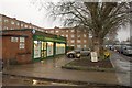
Shop, Verdun Road, SW13
This convenience store and off licence is backed by Windermere Court, most of which is in Image
Image: © Derek Harper
Taken: 6 Jan 2011
0.09 miles
6
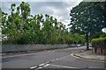
Barnes : Verdun Road
Verdun Road seen from Washington Road.
Image: © Lewis Clarke
Taken: 27 Jun 2022
0.12 miles

8
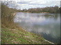
Lonsdale Road Reservoir
Lonsdale Road Local Nature Reserve was formerly a reservoir, now disused. It is also known as the Leg O' Mutton. Close to the River Thames, and only separated from the river by a narrow strip of woodland, it is a peaceful spot with a path following the western side, accessible from the Thames Path. This view looks across the northern end to flats in Lonsdale Road.
Image: © Marathon
Taken: 9 Mar 2011
0.13 miles
10

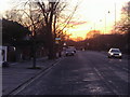
Houses on Lonsdale Road
Looking across a playing field from the Thames Path.
Image: © Robin Webster
Taken: 14 Apr 2012
0.14 miles