IMAGES TAKEN NEAR TO
Cornford Grove, LONDON, SW12 9JE

Introduction

This page details the photographs taken nearby to Cornford Grove, SW12 9JE by members of the Geograph project.

The Geograph project started in 2005 with the aim of publishing, organising and preserving representative images for every square kilometre of Great Britain, Ireland and the Isle of Man.

There are currently over 7.5m images from over14,400 individuals and you can help contribute to the project by visiting https://www.geograph.org.uk

Image Map


Images are licensed for reuse under creativecommons.org/licenses/by-sa/2.0
Notes
  • Clicking on the map will re-center to the selected point.
  • The higher the marker number, the further away the image location is from the centre of the postcode.

Image Listing (85 Images Found)

Images are licensed for reuse under creativecommons.org/licenses/by-sa/2.0
  • ...
Image
Details
Distance
1
Ryde Vale Road
Image: © James Emmans Taken: 8 May 2022
0.05 miles
2
Homemead
Apartment block.
Image: © James Emmans Taken: 8 May 2022
0.05 miles
3
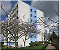
Blue and White Block
Basically a functional apartment block like so many others, but just this simple colour scheme gives a sense of style.
Image: © Des Blenkinsopp Taken: 31 Mar 2015
0.07 miles
4
Railway lines merge
Image: © N Chadwick Taken: 7 May 2011
0.08 miles
5
House on Bedford Hill, Balham
Image: © Oast House Archive Taken: 29 Apr 2005
0.09 miles
6
Bedford Hill, Balham
Image: © David Howard Taken: 29 Sep 2013
0.11 miles
7
Dornton Road, Balham, from a passing train
Image: © Christopher Hilton Taken: 22 Sep 2011
0.12 miles
8
Bedford Hill (B242)
Just visible on the left is the former church of St John the Divine, now a health centre.
Image: © N Chadwick Taken: 8 May 2010
0.12 miles
9
Fernlea Rd
Image: © N Chadwick Taken: 3 Feb 2018
0.12 miles
10
Shared path, Tooting Bec Common
This path across Tooting Bec Common is shared by pedestrians and cyclists.
Image: © Malc McDonald Taken: 30 May 2011
0.12 miles
  • ...