1
Junctions in Balham
Temperley Road (foreground) passes Badminton Road (left) and meets Bellamy Street (right).
Image: © Derek Harper
Taken: 8 Feb 2015
0.08 miles
2
Balham, postbox
Victorian box on Bellamy Road; ID: SW12 19.
Image: © Mike Faherty
Taken: 27 Apr 2013
0.08 miles
3
Sainsbury filling station, Nightingale Lane
An interesting bit of research http://list.english-heritage.org.uk/resultsingle.aspx?uid=1357669 showed that as of 1983, this was an Elf petrol station but is now part of a supermarket chain.
Petrol was retailing at 125.9p per litre.
Image: © Stephen Craven
Taken: 26 Apr 2014
0.10 miles
4
40 Nightingale Lane, Clapham
This building bears a blue plaque proclaiming it as the former home of H E Bateman, cartoonist.
Image: © Stephen Craven
Taken: 26 Apr 2014
0.10 miles
5
Houses on Alderbrook Road, Balham
Opposite the junction with Temperley Road.
Image: © Derek Harper
Taken: 8 Feb 2015
0.10 miles
6
Clapham Park, shopping parade
At the corner of Nightingale Lane and Blandfield Road; premises include convenience store, dry cleaners, estate agent, patisserie.
Image: © Mike Faherty
Taken: 27 Oct 2012
0.11 miles
7
Old Boundary Marker by the B229, Nightingale Lane, Battersea
Parish Boundary Marker by the B229, in parish of Battersea (Wandsworth District), Nightingale Lane SW12, on end of wall between Clavering Place and service station, 50cm above ground, right-hand side.
Grade II Listed. List Entry Number: 1357669
https://historicengland.org.uk/listing/the-list/list-entry/1357669
Surveyed
Milestone Society National ID: SY_BATT02pb.
Image: © Milestone Society
Taken: Unknown
0.11 miles
8
Old Boundary Marker by Alderbrook Road, Clapham Parish
Parish Boundary Marker by the UC road, in parish of Clapham (Lambeth District), Alderbrook Road SW12, outside No 68 against wall, just South of the junction with Bellamy Street.
Surveyed
Milestone Society National ID: SY_CLAP09pb.
Image: © Milestone Society
Taken: Unknown
0.12 miles
9
Old Boundary Marker by the B229, Nightingale Lane SW12
Parish Boundary Marker by the B229, in parish of Battersea (Wandsworth District), Nightingale Lane SW12, on end of wall between Clavering Place and service station, 50cm above ground, left-hand side.
Boundary Wall Grade II listed.
List Entry Number: 1357669 https://historicengland.org.uk/listing/the-list/list-entry/1357669
Surveyed
Milestone Society National ID: SY_BATT01pb.
Image: © Milestone Society
Taken: Unknown
0.12 miles
10
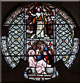
The Ascension, Balham - Bapistery window
Image: © John Salmon
Taken: 27 Jan 2015
0.12 miles


