
IMAGES TAKEN NEAR TO
Bracken Avenue, LONDON, SW12 8BJ
Introduction
This page details the photographs taken nearby to Bracken Avenue, SW12 8BJ by members of the Geograph project.
The Geograph project started in 2005 with the aim of publishing, organising and preserving representative images for every square kilometre of Great Britain, Ireland and the Isle of Man.

There are currently over 7.5m images from over14,400 individuals and you can help contribute to the project by visiting https://www.geograph.org.uk
Image Map
Images are licensed for reuse under creativecommons.org/licenses/by-sa/2.0
Notes
- Clicking on the map will re-center to the selected point.
- The higher the marker number, the further away the image location is from the centre of the postcode.
Image Listing (137 Images Found)
Images are licensed for reuse under creativecommons.org/licenses/by-sa/2.0
Image
Details
Distance
1
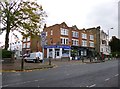
Clapham Park, shopping parade
At the corner of Nightingale Lane and Blandfield Road; premises include convenience store, dry cleaners, estate agent, patisserie.
Image: © Mike Faherty
Taken: 27 Oct 2012
0.08 miles
2
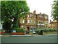
40 Nightingale Lane, Clapham
This building bears a blue plaque proclaiming it as the former home of H E Bateman, cartoonist.
Image: © Stephen Craven
Taken: 26 Apr 2014
0.09 miles
3
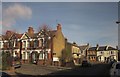
Junctions in Balham
Temperley Road (foreground) passes Badminton Road (left) and meets Bellamy Street (right).
Image: © Derek Harper
Taken: 8 Feb 2015
0.09 miles
4
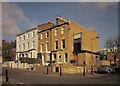
Houses on Ramsden Road, Balham
The house on the corner with Temperley Road was extended by project architects Matthew Heywood Limited.
Image: © Derek Harper
Taken: 8 Feb 2015
0.10 miles
5
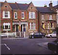
Endlesham Road
View eastwards from Western Lane towards the typical Victorian houses on Endlesham Road. This area is now much more up-market than when I used to live there in the 1970s.
Image: © Trevor Rickard
Taken: Unknown
0.10 miles
6
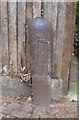
Old Boundary Marker by the B229, Nightingale Lane, Battersea
Parish Boundary Marker by the B229, in parish of Battersea (Wandsworth District), Nightingale Lane SW12, at corner with Ramsden Road, against fence.
Surveyed
Milestone Society National ID: SY_BATT17pb
Image: © Milestone Society
Taken: Unknown
0.10 miles
7
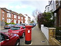
Balham, postbox
Victorian box on Bellamy Road; ID: SW12 19.
Image: © Mike Faherty
Taken: 27 Apr 2013
0.10 miles
8
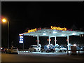
Sainsbury filling station, Nightingale Lane
An interesting bit of research http://list.english-heritage.org.uk/resultsingle.aspx?uid=1357669 showed that as of 1983, this was an Elf petrol station but is now part of a supermarket chain.
Petrol was retailing at 125.9p per litre.
Image: © Stephen Craven
Taken: 26 Apr 2014
0.12 miles
9
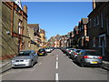
Old Park Avenue, Clapham
Road viewed from Nightingale Lane.
Image: © Alex McGregor
Taken: 8 Mar 2010
0.12 miles
10
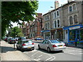
Nightingale Lane SW12
At the corner of Endlesham Road. Looking towards Clapham South tube station.
Image: © Danny P Robinson
Taken: 16 Jun 2006
0.13 miles