
IMAGES TAKEN NEAR TO
Parkgate Road, LONDON, SW11 4NA
Introduction
This page details the photographs taken nearby to Parkgate Road, SW11 4NA by members of the Geograph project.
The Geograph project started in 2005 with the aim of publishing, organising and preserving representative images for every square kilometre of Great Britain, Ireland and the Isle of Man.

There are currently over 7.5m images from over14,400 individuals and you can help contribute to the project by visiting https://www.geograph.org.uk
Image Map
Images are licensed for reuse under creativecommons.org/licenses/by-sa/2.0
Notes
- Clicking on the map will re-center to the selected point.
- The higher the marker number, the further away the image location is from the centre of the postcode.
Image Listing (345 Images Found)
Images are licensed for reuse under creativecommons.org/licenses/by-sa/2.0
Image
Details
Distance
1
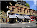
The Butcher and Grill Pub, Battersea
Parkgate Road, Battersea LONDON SW11 4NP close to The River Thames Tideway
Image: © canalandriversidepubs co uk
Taken: 9 Jul 2010
0.03 miles
2

The London A to Z, from the first entry to the last (169)
Shops in Parkgate Street
Image: © Basher Eyre
Taken: 31 Mar 2026
0.03 miles
3
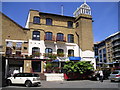
Ransome's Dock Restaurant and Bar Pub, Battersea
Parkgate Road, Battersea LONDON SW11 4NP close to The River Thames Tideway
Image: © canalandriversidepubs co uk
Taken: 9 Jul 2010
0.03 miles
4
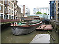
Battersea: Ransome's Dock (1)
This is one of the last surviving docks built off the River Thames upstream of the Tower of London. The dock is dog-legged with a narrow straight section leading off the river, with this wider dock to the south. The 1874 Edition of the Ordnance Survey mapping shows only the straight section, but by the time the 1896 Edition was published this pool is shown too. The brick chimney may have been part of the foundry shown on the 1874 map, while Image peeps out behind it. Ransome's Dock Restaurant is on the left.
Image: © Nigel Cox
Taken: 28 May 2008
0.03 miles
5

The London A to Z, from the first entry to the last (168)
Worfield Street
Image: © Basher Eyre
Taken: 31 Mar 2026
0.04 miles
6

The London A to Z, from the first entry to the last (166)
Parkgate Road, looking towards its junction with Worfield Street
Image: © Basher Eyre
Taken: 31 Mar 2026
0.04 miles
7

The London A to Z, from the first entry to the last (167)
Looking east-southeast in Parkgate Street
Image: © Basher Eyre
Taken: 31 Mar 2026
0.04 miles
8

The London A to Z, from the first entry to the last (165)
Junction of Anhalt Road and Parkside Road
Image: © Basher Eyre
Taken: 31 Mar 2026
0.04 miles
9
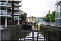
Ransome's Dock
One of many small disused docks along the Thames in London.
Image: © N Chadwick
Taken: 25 Aug 2010
0.05 miles
10

Chelsea from the air
Battersea is in the foreground, south of the Thames. Seen on approach to Heathrow from the east.
Image: © Thomas Nugent
Taken: 28 Feb 2019
0.06 miles