IMAGES TAKEN NEAR TO
Humber Drive, STOKE-ON-TRENT, ST8 7LW
Introduction
This page details the photographs taken nearby to Humber Drive, ST8 7LW by members of the Geograph project.
The Geograph project started in 2005 with the aim of publishing, organising and preserving representative images for every square kilometre of Great Britain, Ireland and the Isle of Man.

There are currently over 7.5m images from over14,400 individuals and you can help contribute to the project by visiting https://www.geograph.org.uk
Image Map
Images are licensed for reuse under creativecommons.org/licenses/by-sa/2.0
Notes
- Clicking on the map will re-center to the selected point.
- The higher the marker number, the further away the image location is from the centre of the postcode.
Image Listing (172 Images Found)
Images are licensed for reuse under creativecommons.org/licenses/by-sa/2.0
Image
Details
Distance
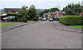
1
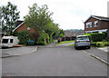
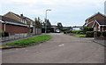
Path from Palmerston Way
This short path links the top end of Palmerston Way with Humber Drive. (See also Image)
Image: © Jonathan Kington
Taken: 5 Sep 2010
0.02 miles
2
North on Humber Drive
Looking along the north arm at the bottom end of Humber Drive, it ends at the trees. There is an easting gridline crossing about halfway along so that the far end is in the next gridsquare north.
Image: © Jonathan Kington
Taken: 5 Sep 2010
0.03 miles
3
Path from Humber Drive
This short path links Humber Drive with the top of Palmerston Way. (See also Image)
Image: © Jonathan Kington
Taken: 5 Sep 2010
0.03 miles
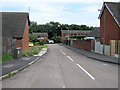
4
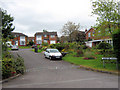
Humber Drive
Looking down Humber Drive from its junction with Thames Drive. Congleton Edge and Mow Cop can be seen in the distance.
Image: © Jonathan Kington
Taken: 29 Aug 2010
0.04 miles
5
Looking south on Humber Drive
Looking along the southern arm of the bottom of Humber Drive.
Image: © Jonathan Kington
Taken: 5 Sep 2010
0.04 miles
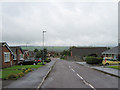
6
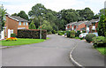
Top end of Palmerston Way
This is the top end of Palmerston Way where it swings north before travelling a short distance to the trees visible at the end. It also crosses an easting gridline approximately where the row of sett stones cross the road, taking it into the next gridsquare to the north.
Image: © Jonathan Kington
Taken: 5 Sep 2010
0.05 miles
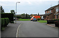
7
Looking towards Humber Drive
Image: © Jonathan Kington
Taken: 5 Sep 2010
0.05 miles
8
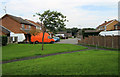
The top of Gladstone Grove
This is the top spur of Gladstone Grove where it comes to an end.
Image: © Jonathan Kington
Taken: 13 Sep 2010
0.06 miles
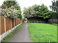
9
Looking down Palmerston Way
Looking from the top of Palmerston Way down towards Thames Drive.
Image: © Jonathan Kington
Taken: 5 Sep 2010
0.06 miles
10
The end of Humber Drive
Image: © Jonathan Kington
Taken: 5 Sep 2010
0.07 miles