
IMAGES TAKEN NEAR TO
Norfolk Grove, STOKE-ON-TRENT, ST8 6DQ
Introduction
This page details the photographs taken nearby to Norfolk Grove, ST8 6DQ by members of the Geograph project.
The Geograph project started in 2005 with the aim of publishing, organising and preserving representative images for every square kilometre of Great Britain, Ireland and the Isle of Man.

There are currently over 7.5m images from over14,400 individuals and you can help contribute to the project by visiting https://www.geograph.org.uk
Image Map
Images are licensed for reuse under creativecommons.org/licenses/by-sa/2.0
Notes
- Clicking on the map will re-center to the selected point.
- The higher the marker number, the further away the image location is from the centre of the postcode.
Image Listing (180 Images Found)
Images are licensed for reuse under creativecommons.org/licenses/by-sa/2.0
Image
Details
Distance
1
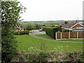
Sawyer Drive
Looking down Sawyer Drive from the Biddulph Valley Way, a former railway line now used as a popular track for walkers, cyclists and horse riders.
Image: © Jonathan Kington
Taken: 26 May 2010
0.06 miles
2
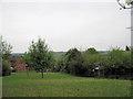
Amenity grassland
This small area of grassland is at the south-western end of Image and beside the Biddulph Valley Way, a former railway line that is now a popular track used by walkers, cyclists and horse riders.
Image: © Jonathan Kington
Taken: 26 May 2010
0.08 miles
3
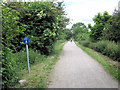
Looking along Biddulph Valley Way
Biddulph Valley Way is a former railway line that is now a popular track for walkers, cyclists and horse riders. It is also part of Sustran's National Route 55.
Image: © Jonathan Kington
Taken: 25 Jun 2010
0.10 miles
4
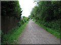
Biddulph Valley Way
Biddulph Valley Way follows the old railway line that runs from the former colliery at Chatterly Whitfield to Congleton. It is a very popular route for walkers, cyclists and horse riders. It is maintained by Staffordshire County Council and is part of Sustran's cycle route 55.
Image: © Jonathan Kington
Taken: 7 Jun 2009
0.10 miles
5
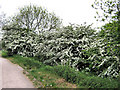
May blossom by the Biddulph Valley Way
These Hawthorns (or May bushes) are in full bloom beside the former railway line that is now a popular track used by walkers, cyclists and horse riders.
Image: © Jonathan Kington
Taken: 26 May 2010
0.11 miles
6
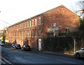
Looking down to Albion Mills
At 200 feet long and 50 feet wide covering three floors, Albion Mills is the biggest of Biddulph's former mills. Built in 1884 as a fustian mill, its early records are unfortunately lost and the original ownership is unclear. It is now closed and its future seems to be unknown.
Fustian is thought to originate in Fustat, Egypt at around 200 AD. It is a strong, durable cloth made from a cotton weave that has loosely laid wefts (cross-threads) that form loops above the ground weave. These loops are then cut to produce the familiar ridged appearance on corduroy. Before machines were invented to do this job, it was a highly skilled manual task carried out by both men and women. A specially shaped knife was used that had to be sharpened at the start of every day by a trained sharpener, who was also often a master-cutter himself. The knife would be held in one hand (some could use two at once) whilst the cutter would walk along the bolt of cloth that had been laid over rollers and stretched from one end of the factory to the other. The knives were as thin as a razor and as supple as a watch spring which fitted into a guard that was held between the fingers. Every cutter had his or her unique style with no two cutters holding the knife at the same angle to the cloth, this meant that if a different person took over a length of cloth from another then the change would show in the nap and that length of cloth was ruined. Cutters always wore clogs because, with the long distances walked every day, shoes wore out too quickly. To produce a 145 yard pair of pieces of finest quality fustian required the worker to walk a total of 72 miles. A man would usually be expected to make four pieces a week, working very long hours and earning 16 shillings (80 pence) in that week.
Image: © Jonathan Kington
Taken: 24 Nov 2010
0.11 miles
7
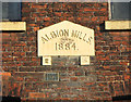
Date plaque for Albion Mills
This is the date stone for Image
Image: © Jonathan Kington
Taken: 24 Nov 2010
0.11 miles
8
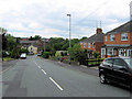
South along Station Road
Looking south down Station Road from its junction with Halls Lane to where it crosses Biddulph Brook. See also Image, Image, Image and Image
Image: © Jonathan Kington
Taken: 25 Jun 2010
0.11 miles
9
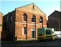
Old chapel
This former Wesleyan chapel, built in 1856, stands on Station Road next to Image Late 19th century maps refer to Station Road as Chapel Street and this chapel is marked as Methodist Chapel (Primitive). Sadly it is sliding into a state of dereliction now.
Image: © Jonathan Kington
Taken: 24 Nov 2010
0.11 miles
10
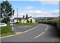
Craigside by Meadows Way
Looking along Craigside where it runs almost parallel with Meadows Way to Station Road near the traffic lights.
Image: © Jonathan Kington
Taken: 30 Aug 2010
0.11 miles