IMAGES TAKEN NEAR TO
Hawthorne Avenue, STOKE-ON-TRENT, ST7 8NQ
Introduction
This page details the photographs taken nearby to Hawthorne Avenue, ST7 8NQ by members of the Geograph project.
The Geograph project started in 2005 with the aim of publishing, organising and preserving representative images for every square kilometre of Great Britain, Ireland and the Isle of Man.

There are currently over 7.5m images from over14,400 individuals and you can help contribute to the project by visiting https://www.geograph.org.uk
Image Map
Images are licensed for reuse under creativecommons.org/licenses/by-sa/2.0
Notes
- Clicking on the map will re-center to the selected point.
- The higher the marker number, the further away the image location is from the centre of the postcode.
Image Listing (26 Images Found)
Images are licensed for reuse under creativecommons.org/licenses/by-sa/2.0
Image
Details
Distance
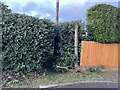
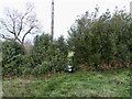
1
Public footpath off Boon Hill Road
This is the opposite side of the lane from https://www.geograph.org.uk/photo/7371115 and continues the route of the Two Saints Way.
Image: © Jonathan Hutchins
Taken: 30 Dec 2022
0.14 miles
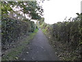
2
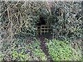
Public footpath off Boon Hill Road
The narrow gap is made difficult of access by encroaching holly. It is part of the Two Saints Way.
Image: © Jonathan Hutchins
Taken: 30 Dec 2022
0.15 miles
3
Wood Lane: footpath off Apedale Road
The footpath leads to Apedale Country Park.
Image: © Jonathan Hutchins
Taken: 15 Oct 2016
0.18 miles
5
Stile onto Peggy's Bank
Footpath Audley FP 99 enters and leaves Peggy's Bank by way of this stile in a hedge.
Image: © Jonathan Hutchins
Taken: 11 Dec 2022
0.21 miles
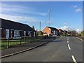
6
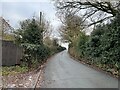
Peggy's Bank
This photo does not do justice to the steepness of Peggy's Bank, which is depicted with double chevrons on the 1:25000 OS map, signifying it has a gradient steeper than 20% or 1 in 5. No road sign at its foot warns of this.
Image: © Jonathan Hutchins
Taken: 11 Dec 2022
0.21 miles
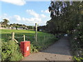
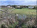
7
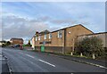
Wood Lane: path along north side of village
On the left are houses and on the right open fields.
Image: © Jonathan Hutchins
Taken: 15 Oct 2016
0.21 miles
8
Two Saints Way looking towards Boon Hill
Image: © Jonathan Hutchins
Taken: 30 Dec 2022
0.21 miles
10
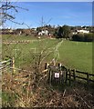
Boon Hill: footpath off former railway trackbed
This short stretch of public right of way, designated Audley 31, between the old Audley branch line and Boon Hill Road, appears to have a fence unhelpfully strung across its route towards the far side.
Image: © Jonathan Hutchins
Taken: 6 Apr 2015
0.22 miles