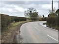
IMAGES TAKEN NEAR TO
Shraley Brook Road, STOKE-ON-TRENT, ST7 8AW
Introduction
This page details the photographs taken nearby to Shraley Brook Road, ST7 8AW by members of the Geograph project.
The Geograph project started in 2005 with the aim of publishing, organising and preserving representative images for every square kilometre of Great Britain, Ireland and the Isle of Man.

There are currently over 7.5m images from over14,400 individuals and you can help contribute to the project by visiting https://www.geograph.org.uk
Image Map
Images are licensed for reuse under creativecommons.org/licenses/by-sa/2.0
Notes
- Clicking on the map will re-center to the selected point.
- The higher the marker number, the further away the image location is from the centre of the postcode.
Image Listing (10 Images Found)
Images are licensed for reuse under creativecommons.org/licenses/by-sa/2.0
Image
Details
Distance
1
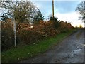
Halmer End: farm track and public footpath
The track leads to Golden Hay Farm, but is also the route of public footpath Audley FP 88.
Image: © Jonathan Hutchins
Taken: 22 Nov 2015
0.08 miles
2

Wild flowers in the hedgerow
Hedgerow in Shraleybrook Road adorned with white flowers
Image: © Peter Fleming
Taken: 3 Sep 2007
0.11 miles
3
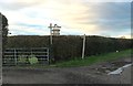
Halmer End: farm track and public footpath
The track leads to Pheasants Hall and Pheasants Lodge, but is also the route of public footpath Audley FP 52.
Image: © Jonathan Hutchins
Taken: 22 Nov 2015
0.15 miles
4
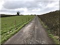
Track to Pheasant Hall
This is also the route of a public footpath.
Image: © Jonathan Hutchins
Taken: 17 Mar 2018
0.18 miles
5

Track to Pheasant Hall
The long and straight track south from Shraylybrook Road
Image: © Peter Fleming
Taken: 3 Sep 2007
0.22 miles
6
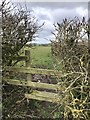
Stile into field near Pheasant Hall
This is the opposite side of the drive from https://www.geograph.org.uk/photo/5709819 . The footpath is designated Audley 51.
Image: © Jonathan Hutchins
Taken: 17 Mar 2018
0.24 miles
7
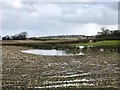
Flooded field near Halmer End
The village of Audley is on the high ground on the horizon.
Image: © Jonathan Hutchins
Taken: 17 Mar 2018
0.24 miles
9
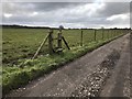
Footpath crossroads on drive to Pheasant Hall
The drive itself is the route of a public footpath, which is crossed here by another public footpath. The other end of this short right of way was at this point blocked by ovines; see Image
Image: © Jonathan Hutchins
Taken: 17 Mar 2018
0.25 miles