
IMAGES TAKEN NEAR TO
Shelley Close, STOKE-ON-TRENT, ST7 4JB
Introduction
This page details the photographs taken nearby to Shelley Close, ST7 4JB by members of the Geograph project.
The Geograph project started in 2005 with the aim of publishing, organising and preserving representative images for every square kilometre of Great Britain, Ireland and the Isle of Man.

There are currently over 7.5m images from over14,400 individuals and you can help contribute to the project by visiting https://www.geograph.org.uk
Image Map
Images are licensed for reuse under creativecommons.org/licenses/by-sa/2.0
Notes
- Clicking on the map will re-center to the selected point.
- The higher the marker number, the further away the image location is from the centre of the postcode.
Image Listing (15 Images Found)
Images are licensed for reuse under creativecommons.org/licenses/by-sa/2.0
Image
Details
Distance
2
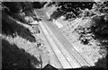
Derelict rail line near Kidsgrove
When photographed in 1966, this section of line had recently become derelict following the opening of a diversionary route. The photographer is standing above the north portal of Harecastle South tunnel, and the south portal of Harecastle Middle tunnel can just be seen. The diversion arose as the three Victorian Harecastle rail tunnels had insufficient clearance for the electric overhead cables being installed as an early phase of the electrification of the West Coast Main Line and its subsidiary feeders.
Image: © Flying Stag
Taken: Unknown
0.08 miles
3
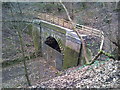
North portal of disused Harecastle South railway tunnel
The Harecastle railway tunnels south of Kidsgrove were abandoned in 1965 after the line was diverted above ground through Bathpool Park to rejoin the original route at Chatterley. The diversion was deemed necessary due to electrification, for which the tunnels offered insufficient clearance.
Image: © Jonathan Hutchins
Taken: 12 Mar 2011
0.11 miles
4
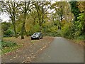
Access road to Bathpool Car park
Underneath this short stretch of road leading down from Boathorse Road lie a disused railway tunnel, and at greater depth the two Harecastle tunnels of the Trent and Mersey Canal.
Image: © Stephen Craven
Taken: 27 Oct 2024
0.12 miles
5
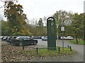
Car park for Bathpool Country Park
The car park occupies the site of some 19th century colliery buildings.
Image: © Stephen Craven
Taken: 27 Oct 2024
0.14 miles
6
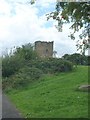
Remains of old windmill
Now surrounded by modern housing estate.
Image: © Barry Boxer
Taken: 16 Aug 2009
0.15 miles
7
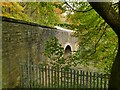
Southern portal of Harecastle 'new' railway tunnel
As explained by another contributor Image this tunnel is on a diversionary route opened in 1965. The ground under this part of Kidsgrove is a warren of human excavations, with one current and three abandoned railway tunnels, a pair of canal tunnels, and several disused mine shafts, presumably with associated levels.
Image: © Stephen Craven
Taken: 27 Oct 2024
0.15 miles
8

Footpath through Bathpool Wood
The path is not very clear on the ground, especially in autumn with leaf fall well under way. However, it is marked on Open Street Map and also on the 1899 OS map which oddly shows a footbridge crossing it about here. That map shows the path linking two (already closed) small collieries, and the 1879 map shows it to have been the route of an earlier tramway.
Image: © Stephen Craven
Taken: 27 Oct 2024
0.19 miles
9
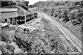
Harecastle railway tunnel
A diesel multiple-unit bound for Stoke-on-Trent enters the (then) new Harecastle Tunnel. The now derelict line through the old tunnels can be seen clearly.
Image: © Flying Stag
Taken: Unknown
0.19 miles
10
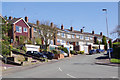
Windmill Avenue, Kidsgrove
Detached and semi-detached houses seen from the junction with Ravenscliffe Road.
Image: © Stephen McKay
Taken: 24 Mar 2017
0.20 miles