IMAGES TAKEN NEAR TO
Gloucester Road, STOKE-ON-TRENT, ST7 4DQ
Introduction
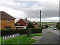
This page details the photographs taken nearby to Gloucester Road, ST7 4DQ by members of the Geograph project.
The Geograph project started in 2005 with the aim of publishing, organising and preserving representative images for every square kilometre of Great Britain, Ireland and the Isle of Man.

There are currently over 7.5m images from over14,400 individuals and you can help contribute to the project by visiting https://www.geograph.org.uk
Image Map
Images are licensed for reuse under creativecommons.org/licenses/by-sa/2.0
Notes
- Clicking on the map will re-center to the selected point.
- The higher the marker number, the further away the image location is from the centre of the postcode.
Image Listing (2 Images Found)
Images are licensed for reuse under creativecommons.org/licenses/by-sa/2.0
Image
Details
Distance
1
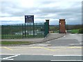
St John RC Primary School
This school is built in a hollow on this very hilly part of Kidsgrove. When driving past the only part of the school visible is the roof.
Image: © Steve Lewin
Taken: 25 Apr 2006
0.21 miles