IMAGES TAKEN NEAR TO
Chells Hill, STOKE-ON-TRENT, ST7 3FB
Introduction
This page details the photographs taken nearby to Chells Hill, ST7 3FB by members of the Geograph project.
The Geograph project started in 2005 with the aim of publishing, organising and preserving representative images for every square kilometre of Great Britain, Ireland and the Isle of Man.

There are currently over 7.5m images from over14,400 individuals and you can help contribute to the project by visiting https://www.geograph.org.uk
Image Map
Images are licensed for reuse under creativecommons.org/licenses/by-sa/2.0
Notes
- Clicking on the map will re-center to the selected point.
- The higher the marker number, the further away the image location is from the centre of the postcode.
Image Listing (16 Images Found)
Images are licensed for reuse under creativecommons.org/licenses/by-sa/2.0
Image
Details
Distance
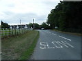
1

Betchton Lane junction at Lawton Heath End
Image: © Mat Fascione
Taken: 11 Jul 2015
0.06 miles
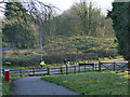
3
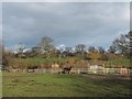
Donkeys by a pond
One of several small natural ponds around Rode Heath.
Image: © Stephen Craven
Taken: 24 Dec 2014
0.08 miles
4
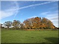
Trees round a pond off Betchton Lane
Image: © Jonathan Hutchins
Taken: 19 Nov 2017
0.12 miles
5
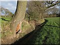
Drainage ditch
This ditch by the edge of a field looks to have been either newly dug or recently cleared.
Image: © Stephen Craven
Taken: 24 Dec 2014
0.19 miles
6
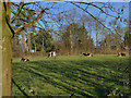
Cows in a field, Lawton Heath
Alongside the Salt Line.
Image: © Stephen Craven
Taken: 30 Dec 2019
0.20 miles
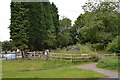
7
Eastern end of the Salt Line at Lawton Heath
The bridge that once carried the railway over Sandbach Road North has been demolished. The cycle trail ends here as an off-road route, continuing on the minor road opposite to join the towpath of the Trent and Mersey Canal nearby.
Image: © Stephen Craven
Taken: 30 Dec 2019
0.20 miles
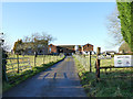
8
South-eastern end of Salt Line trail
Viewed from Sandbach Road North, with Bridge Farm on the left.
Image: © Jonathan Hutchins
Taken: 12 Jul 2015
0.21 miles
9
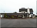
The Horseshoe at Church Lawton
A dining pub on Sandbach Road. See also Image
Image: © Stephen Craven
Taken: 10 Apr 2022
0.22 miles
10
Bridge Farm, Lawton Heath
The dairy farm is named after a railway bridge that has now been demolished.
Image: © Stephen Craven
Taken: 30 Dec 2019
0.23 miles