IMAGES TAKEN NEAR TO
Swan Close, STOKE-ON-TRENT, ST7 1TA
Introduction
This page details the photographs taken nearby to Swan Close, ST7 1TA by members of the Geograph project.
The Geograph project started in 2005 with the aim of publishing, organising and preserving representative images for every square kilometre of Great Britain, Ireland and the Isle of Man.

There are currently over 7.5m images from over14,400 individuals and you can help contribute to the project by visiting https://www.geograph.org.uk
Image Map
Images are licensed for reuse under creativecommons.org/licenses/by-sa/2.0
Notes
- Clicking on the map will re-center to the selected point.
- The higher the marker number, the further away the image location is from the centre of the postcode.
Image Listing (73 Images Found)
Images are licensed for reuse under creativecommons.org/licenses/by-sa/2.0
Image
Details
Distance
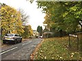
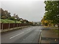
3

Coalpit Hill, Talke
With houses raised above the road, which descends to meet the Newcastle Road.
Image: © Derek Harper
Taken: 30 Jun 2006
0.06 miles
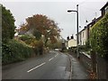
4
Coalpit Hill, Talke
Looking up the hill; the houses on the left will be recognised as those on the right of Image
Image: © Derek Harper
Taken: 30 Jun 2006
0.06 miles
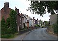
7
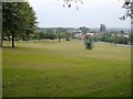
Vanished Talke
A view across a triangular green created in the 1970s on the site of much of the former Victorian village of Talke. John Street and Wesley Street were two streets that were demolished. An evocative account of what was formerly here is at http://www.francisfrith.com/talke/memories/talke-a-forgotten-village_100091/ .
On the right at the foot of the green is the A34 Newcastle Road.
Image: © Derek Harper
Taken: 30 Jun 2006
0.10 miles
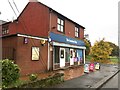
8
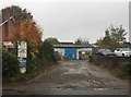
Talke: workshops off Coalpit Hill
Image: © Jonathan Hutchins
Taken: 30 Oct 2016
0.10 miles
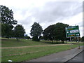
10
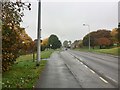
Talke: lay-by and bus stop on A34
On the left just beyond the streetlamp pillar can be seen the signpost and upper end of a short public footpath which cuts down through the adjacent housing estate, as seen in http://www.geograph.org.uk/photo/5175608
Image: © Jonathan Hutchins
Taken: 30 Oct 2016
0.12 miles