IMAGES TAKEN NEAR TO
Mitchell Drive, STOKE-ON-TRENT, ST7 1JL
Introduction
This page details the photographs taken nearby to Mitchell Drive, ST7 1JL by members of the Geograph project.
The Geograph project started in 2005 with the aim of publishing, organising and preserving representative images for every square kilometre of Great Britain, Ireland and the Isle of Man.

There are currently over 7.5m images from over14,400 individuals and you can help contribute to the project by visiting https://www.geograph.org.uk
Image Map
Images are licensed for reuse under creativecommons.org/licenses/by-sa/2.0
Notes
- Clicking on the map will re-center to the selected point.
- The higher the marker number, the further away the image location is from the centre of the postcode.
Image Listing (30 Images Found)
Images are licensed for reuse under creativecommons.org/licenses/by-sa/2.0
Image
Details
Distance


3
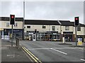
Junction of Cedar Avenue and Congleton Road, Butt Lane
Cedar Avenue the B5371 forms a T-junction with the A34 Congleton Road.
Image: © Jonathan Hutchins
Taken: 15 Jul 2017
0.16 miles
4
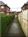
Kidsgrove: path between houses on Maple Avenue
This is the conclusion of the public footpath also seen in http://www.geograph.org.uk/photo/5175608 and http://www.geograph.org.uk/photo/5175621
Image: © Jonathan Hutchins
Taken: 30 Oct 2016
0.17 miles
5
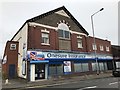
Butt Lane Industrial Co-Operative Society building
The Butt Lane Industrial Co-Operative Society was established in February 1879. The original building dated from 1891 and was enlarged and altered on a number of occasions: in fact a comparison with a 1930s photograph https://www.search.staffspasttrack.org.uk/Details.aspx?&ResourceID=4659&SearchType=2&ThemeID=40 shows that this 1903 structure is merely a fragment of a much larger building which occupied the whole of the corner of Congleton Road and Church Street.
Image: © Jonathan Hutchins
Taken: 15 Jul 2017
0.19 miles
6
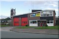
Kidsgrove fire station
Kidsgrove fire station, Lower Ash Road, Kidsgrove, Staffordshire.
Image: © Kevin Hale
Taken: 21 Oct 2006
0.19 miles
7
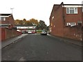
Kidsgrove: cul-de-sac off Unity Way
At the top right of the cul-de-sac is the Premier store seen in http://www.geograph.org.uk/photo/5175615
This cul-de-sac is also the continuation of the public footpath seen in http://www.geograph.org.uk/photo/5175615
Image: © Jonathan Hutchins
Taken: 30 Oct 2016
0.19 miles
9
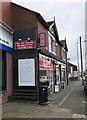
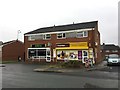
Shops on Congleton Road, Butt Lane
Image: © Jonathan Hutchins
Taken: 15 Jul 2017
0.20 miles