1
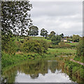
Caldon Canal north of Milton, Stoke-on-Trent
Image: © Roger D Kidd
Taken: 31 Jul 2015
0.23 miles
2
Caldon Canal north of Milton, Stoke-on-Trent
The Caldon Branch of the Trent and Mersey Canal was created, and opened in 1779, specifically as a transport facility for the limestone quarries at Cauldon, near Froghall. In 1797 a secondary branch was built from Hazlehurst Locks to Leek. By 1811 a further extension from Froghall led to Uttoxeter, a further 13 miles, but only lasted until 1845. By 1849 a railway had been built, some of the track using the former canal bed.
Due mainly to railways taking most of the trade, the canal became little used and almost unnavigable by the early 1960s.
The canal was reopened in 1974 following enormous amounts of work instigated by the Caldon Canal Society, its volunteers, and the British Waterways Board. The current seventeen miles from Etruria to Froghall are a particularly attractive canal for cruising, despite the seventeen locks.
Image: © Roger D Kidd
Taken: 31 Jul 2015
0.23 miles
3
Caldon Canal north of Milton, Stoke-on-Trent
Looking north towards Norton Green.
The Caldon Branch of the Trent and Mersey Canal was created, and opened in 1779, specifically as a transport facility for the limestone quarries at Cauldon, near Froghall. In 1797 a secondary branch was built from Hazlehurst Locks to Leek. By 1811 a further extension from Froghall led to Uttoxeter, a further 13 miles, but only lasted until 1845. By 1849 a railway had been built, some of the track using the former canal bed.
Due mainly to railways taking most of the trade, the canal became little used and almost unnavigable by the early 1960s.
The canal was reopened in 1974 following enormous amounts of work instigated by the Caldon Canal Society, its volunteers, and the British Waterways Board. The current seventeen miles from Etruria to Froghall are a particularly attractive canal for cruising, despite the seventeen locks ... well that isn't too many, is it? ;-)
Image: © Roger D Kidd
Taken: 31 Jul 2015
0.24 miles
4
The Caldon Canal in more open countryside on the north edge of Stoke-on-Trent
Having followed the River Trent from its mouth, I am now in the valley of the River 'Head of Trent'.
Image: © Tim Heaton
Taken: 18 Apr 2018
0.24 miles
5
Canal and farmland north-west of Milton, Stoke-on-Trent
This is the Caldon Canal, looking north towards Engine Lock, No 4 which is about five hundred metres ahead.
Image: © Roger Kidd
Taken: 12 Sep 2019
0.24 miles
6
Canada geese north of Milton, Stoke-on-Trent
These beautiful, but much maligned birds are seen here on the Caldon Canal north of Milton.
Image: © Roger D Kidd
Taken: 31 Jul 2015
0.24 miles
7
Caldon Canal north-west of Milton, Stoke-on-Trent
This is south of Engine Lock, but looking north towards Norton-in-the-Moors.
Image: © Roger Kidd
Taken: 12 Sep 2019
0.25 miles


