IMAGES TAKEN NEAR TO
Longbridge Hayes Road, STOKE-ON-TRENT, ST6 4QZ

Introduction

This page details the photographs taken nearby to Longbridge Hayes Road, ST6 4QZ by members of the Geograph project.

The Geograph project started in 2005 with the aim of publishing, organising and preserving representative images for every square kilometre of Great Britain, Ireland and the Isle of Man.

There are currently over 7.5m images from over14,400 individuals and you can help contribute to the project by visiting https://www.geograph.org.uk

Image Map


Images are licensed for reuse under creativecommons.org/licenses/by-sa/2.0
Notes
  • Clicking on the map will re-center to the selected point.
  • The higher the marker number, the further away the image location is from the centre of the postcode.

Image Listing (34 Images Found)

Images are licensed for reuse under creativecommons.org/licenses/by-sa/2.0
  • ...
Image
Details
Distance
1
A500 near Longport
Image: © Peter Whatley Taken: 24 Mar 2011
0.07 miles
2
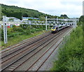
Train heading north along the Crewe to Derby railway line
Image: © Mat Fascione Taken: 11 Jul 2015
0.08 miles
3
Westport Lake: bridge over stream in the Conservation Area
This small bridge carried the former Tunstall branch railway line over this stream.
Image: © Jonathan Hutchins Taken: 30 Dec 2014
0.09 miles
4
View south from the footbridge
On the left is the Crewe to Derby railway line, with Longbridge Hayes Road on the right.
Image: © Mat Fascione Taken: 11 Jul 2015
0.12 miles
5
Footbridge across the Crewe to Derby railway line
Image: © Mat Fascione Taken: 11 Jul 2015
0.12 miles
6
Longport - Peel Street footbridge
Image: © Dave Bevis Taken: 7 Jul 2011
0.13 miles
7
Westport Lake: path, information board and bridge in the Conservation Area
'Trees and Shrubs of Westport Lake', proclaims the information board. This may be useful when trees are in leaf, but not at the season this photograph was taken!
Image: © Jonathan Hutchins Taken: 30 Dec 2014
0.13 miles
8
Footbridge over the Train Lines, Two Saints Way Path, Longport
Image: © Brian Deegan Taken: 22 Aug 2021
0.14 miles
9
The A500 West of Tunstall
Image: © Anthony Parkes Taken: 24 Jan 2013
0.14 miles
10
The A500 near Burslem
Image: © Anthony Parkes Taken: 24 Jan 2013
0.14 miles
  • ...