IMAGES TAKEN NEAR TO
St. Georges Avenue, NEWCASTLE, ST5 8DH
Introduction
This page details the photographs taken nearby to St. Georges Avenue, ST5 8DH by members of the Geograph project.
The Geograph project started in 2005 with the aim of publishing, organising and preserving representative images for every square kilometre of Great Britain, Ireland and the Isle of Man.

There are currently over 7.5m images from over14,400 individuals and you can help contribute to the project by visiting https://www.geograph.org.uk
Image Map
Images are licensed for reuse under creativecommons.org/licenses/by-sa/2.0
Notes
- Clicking on the map will re-center to the selected point.
- The higher the marker number, the further away the image location is from the centre of the postcode.
Image Listing (14 Images Found)
Images are licensed for reuse under creativecommons.org/licenses/by-sa/2.0
Image
Details
Distance
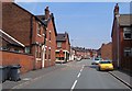
4
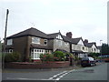
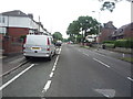
Dimsdale Parade East, Wolstanton
Terraces on the opposite side of the road to Image The junction is with Simpson Street, with, on the corner, a soft furnishings shop which I'll warrant once sold a wider range of goods.
Image: © Derek Harper
Taken: 30 Jun 2006
0.12 miles
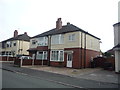
5
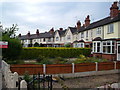
Crescent, Dimsdale Parade East, Wolstanton
A curving terrace built in 1909 on a road mainly characterised by straight lines of houses. My father was born here, four years after the houses were built.
Image: © Derek Harper
Taken: 30 Jun 2006
0.14 miles
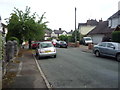
7
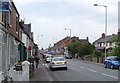
Dimsdale Parade East, Wolstanton
A reverse view of Image, with the Crescent shown in Image on the right. The crossroads is with Wolseley Road / Watlands View.
Image: © Derek Harper
Taken: 30 Jun 2006
0.16 miles
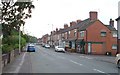
8
Hassam Parade, Dimsdale
Looking north west.
Image: © JThomas
Taken: 11 Jun 2016
0.16 miles
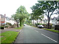
9
Wolseley Road and Watlands View, Wolstanton
The crossroads is with Dimsdale Parade East and the crossroads can be made out in Image
Image: © Derek Harper
Taken: 30 Jun 2006
0.16 miles
10
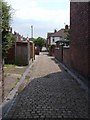
Alley, Wolstanton
Running at the rear of houses on Dimsdale Parade East, the back alley connects Wolseley Road and Hartington Road.
Image: © Derek Harper
Taken: 30 Jun 2006
0.17 miles