
IMAGES TAKEN NEAR TO
John Street, NEWCASTLE, ST5 6DT
Introduction
This page details the photographs taken nearby to John Street, ST5 6DT by members of the Geograph project.
The Geograph project started in 2005 with the aim of publishing, organising and preserving representative images for every square kilometre of Great Britain, Ireland and the Isle of Man.

There are currently over 7.5m images from over14,400 individuals and you can help contribute to the project by visiting https://www.geograph.org.uk
Image Map
Images are licensed for reuse under creativecommons.org/licenses/by-sa/2.0
Notes
- Clicking on the map will re-center to the selected point.
- The higher the marker number, the further away the image location is from the centre of the postcode.
Image Listing (29 Images Found)
Images are licensed for reuse under creativecommons.org/licenses/by-sa/2.0
Image
Details
Distance
2
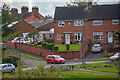
Newcastle-Under-Lyme : Peake Street
Looking across the grassy area to Peake Street and Cotswold Avenue.
Image: © Lewis Clarke
Taken: 22 Sep 2019
0.08 miles
5
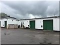
Newcastle Enterprise Centre
The business in the corner is Newcastle Equine Laundry and Saddlery.
Image: © Jonathan Hutchins
Taken: 21 May 2016
0.10 miles
6
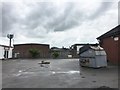
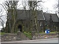
Newcastle Enterprise Centre
Beyond the fence at the far side is Knutton Recreation Centre.
Image: © Jonathan Hutchins
Taken: 21 May 2016
0.10 miles
7
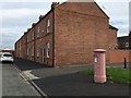
Knutton: Chapel Street
At first I thought the letterbox had been painted thus as part of Breast Cancer Awareness, but in fact it was simply an undercoat: by the evening it was again pillar-box red.
Image: © Jonathan Hutchins
Taken: 23 Sep 2015
0.10 miles
8
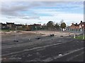
Knutton: site of former Recreation Centre
The Centre closed in 2012 when Newcastle's Jubilee 2 centre opened, and lay empty until it was demolished and the site cleared in November 2016.
Image: © Jonathan Hutchins
Taken: 16 Nov 2016
0.11 miles
9
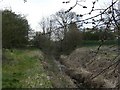
Lyme Brook
One of the many streams known locally as Lyme Brook disappearing under the B5368 never to be seen again.
Image: © Steve Lewin
Taken: 9 Apr 2007
0.13 miles
10
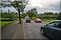
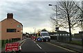
Newcastle-Under-Lyme : Lower Milehouse Lane B5368
Looking along Lower Milehouse Lane.
Image: © Lewis Clarke
Taken: 22 Sep 2019
0.15 miles