
IMAGES TAKEN NEAR TO
Radswood, NEWCASTLE, ST5 5ER
Introduction
This page details the photographs taken nearby to Radswood, ST5 5ER by members of the Geograph project.
The Geograph project started in 2005 with the aim of publishing, organising and preserving representative images for every square kilometre of Great Britain, Ireland and the Isle of Man.

There are currently over 7.5m images from over14,400 individuals and you can help contribute to the project by visiting https://www.geograph.org.uk
Image Map
Images are licensed for reuse under creativecommons.org/licenses/by-sa/2.0
Notes
- Clicking on the map will re-center to the selected point.
- The higher the marker number, the further away the image location is from the centre of the postcode.
Image Listing (7 Images Found)
Images are licensed for reuse under creativecommons.org/licenses/by-sa/2.0
Image
Details
Distance

2

Radwood Farm
A dairy farm north of the Maer Hills.
Image: © Ian Capper
Taken: 4 Oct 2010
0.04 miles
3

Radwood Farm
A dairy farm north of the Maer Hills
Image: © Ian Capper
Taken: 4 Oct 2010
0.04 miles
4

Near Radwood Farm
A field near Radwood Farm
Image: © Ian Capper
Taken: 4 Oct 2010
0.09 miles
5

Maer Hills Notice
For the anti side of the proposed holiday village argument see www.savemaerhills.co.uk or for an offensive (in every meaning of the word) that appears to have been writen by that drunk on the stool at the end of the bar see www.maerhillsactiongroup.co.uk
Image: © Neil Lewin
Taken: 25 May 2007
0.16 miles
6

Newcastle Way Cow Bouncers, Madeley
They were not keen on letting me in!! Maybe it was the Red Rucksack :)
Image: © Brian Deegan
Taken: 11 Apr 2021
0.22 miles
7
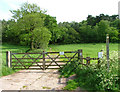
Maer Hills
This footpath leads towards the proposed site for a disputed 'eco holiday village' For the pro-argument see www.evolutionleisurevillage.com
Image: © Neil Lewin
Taken: 25 May 2007
0.24 miles